Camp

Wild Card Cycling’s training camp in southern Illinois was last weekend. I knew what I was getting into after the past two trips. I was a little concerned about my lack of miles this year, but I ended up riding a little better than I thought/feared I would.

Wednesday evening was our regular weekly fight ride. It was tough.

Thursday we left for camp, drove in the pouring rain, arrived in the pouring rain, unpacked in the pouring rain, and rode (you guessed it) in the pouring rain. It was slightly miserable, but not too bad. My legs were not fresh after Wednesday’s ride. I actually felt like crap for about 20 miles. The good news was that I didn’t feel any worse after the next 20. We rode from Giant City to the top of Bald Knob (the highest point in southern Illinois) and back. It was a very hilly 50 miles. Even though the speed wasn’t super-fast, it was still tough.

Friday the sun was shining, but it was cold when we left for the ride. We had some logistical problems and ended up riding in two separate groups after the two groups apparently couldn’t find each other at the predetermined ride start time. No matter, we still had a good ride (again) to the top of Bald Knob and back. After a few detours I ended the day with a (very hilly) 66 miles and a slight sunburn on my exposed left calf below my knee warmer.

Saturday the goal was 100 (very hilly) miles. My legs were toast at the start from the previous three days of riding. I started the ride with a comfortable 18 miles with just Martin. I ended the first 50 tagged on to the back of the fast group, which was too fast for me. I felt like crap and I was 50 miles from my cabin. I made a conscious decision to take it easy and things got better from there. I rode for a while with just Scott. Then we picked up a group who opted for a shorter loop. The last 18 miles I rode with just John S. At 90 miles I felt better than I had 50 miles earlier. That was the biggest surprise of the weekend, that despite never feeling great, I always ended the rides feeling as good as (if not better than) I did at the start. I guess it’s taking me a while to warm up. Anyway, I got an even worse sunburn on Saturday on my left calf below my knee warmer.

The sun be a harsh mistress

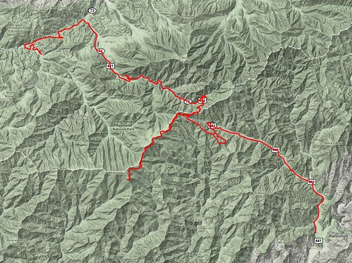
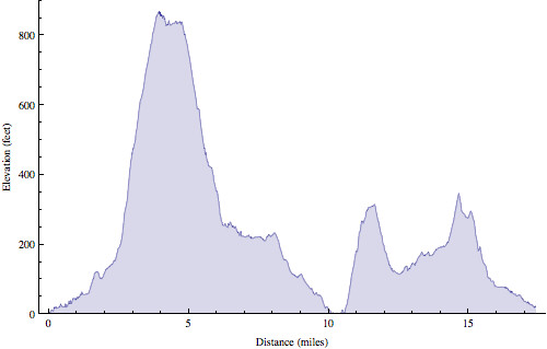
The light red line is from Friday, the dark red line is from Saturday.

Saturday night was dinner at Giant City, which was good times as usual.

Sunday morning it was pouring down rain so everyone ended up leaving early rather than do a dangerous set of hill repeats in the pouring rain. It was very good to get home to see Melissa & Will after a few days away. We made the most of the afternoon with a trip to the park.

The Strangest Marathon

I was moving along at an easy pace. The guy in front of me had just taken a downhill section of the trail very gingerly and nearly tip-toed across a creek crossing. I passed him on the uphill section on the other side of the creek and began to pull away. Then, out of nowhere, I hit the wall. Well, not exactly. I’m not talking about the glycogen depletion “wall” where my fuel reserves have run dry. This was something entirely different and unfamiliar to me. This small incline got my heart beating so fast I was gasping for air only to find I was physically unable to maintain my modest pace. My worst fears had come true. I stopped to walk up the hill. By the time I reached the top I was seriously contemplating dropping out of the marathon.

This was at mile four.

One week prior I was in great spirits, having wrapped up my long training runs and raced fairly well at the FOLEPI River Trail Classic. I showed up at work on Monday feeling as good as possible and left work that evening with a sore throat. My throat got worse through the night and was a full blown illness by Tuesday morning. I went to work (even though I clearly shouldn’t have) only to discover my coworkers were already sick.

By Wednesday my throat started to get better, but the snot and sinus pain got worse. By Thursday evening I was finally starting to feel like I was getting over the sickness. I still wanted to race. I trained really hard for Tecumseh and I wasn’t going to let the sniffles take that away from me.

Friday I travelled to the Nashville, IN area with fellow Buffalo Ken, Brian, and Jen. We stayed at the same paintball/cabin place as last year (though with far fewer people this time). Despite feeling back to normal that morning, by Friday night I felt terrible again. Ugh.

I awoke Saturday morning before the race feeling as fresh as a daisy. Whatever I had seemed to finally work its way out of my system. I thought. We drove to the race finish area, picked up our packets, and loaded up onto the buses to the starting line miles and miles away.
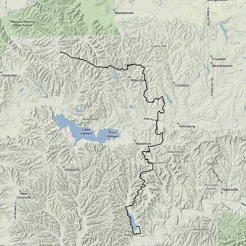
Tecumseh course map

Last year I started way faster than I wanted to, but it was kind of necessary because of the congestion on the single track trail that started 2-3 miles into the race. I vowed to start off slower this year. I ran nice and easy the first mile only to look down when my GPS beeped to read 7:20. The exact same time as last year (and faster than my first mile at the Rockford Marathon where I ran my PR in May). That was the bad news. The good news was that I felt spectacular. Even though that pace felt super easy I made a conscious effort to slow down anyway. For the trail was not nearly as congested as it had been the previous year at this point. Despite the superior weather conditions (sunny rather than snow storm) everyone else was moving slower.

I hit the second mile at 7:29. So much for slowing down. It still felt really easy. I was barely exerting any effort. Still, I decided (once again) to consciously slow down. I hit the third mile in 7:23. Oh, come on. This was too easy. That would be the best I felt all day. We entered the single track trail through the woods, ran down a hill, over a creek, and started back up the other side when my world began to fall apart. This was not going to be my day.

After the first miserable uphill I walked I tried to shake it off and continue on like nothing had happened. I got back up to a comfortable pace on the flat sections of the course, but on the next uphill I found myself gasping for air and walking once again. If after four miles I wanted to quit, then after six miles I really wanted to quit. At this point I decided to stop racing. At the current rate I couldn’t possibly have finished. Instead I slowed down (a lot) in the hope of just dragging myself to the finish line, regardless of time or place. Tecumseh was now a training run. Or so I told myself.

Rob at Tecumseh Marathon

I ran super slow the next four miles, frequently stepping aside to let people pass me on the trail. At the 10.6 mile aid station Ken passed me. Prior to the race I was voted by the others the mostly likely to finish the fastest of our group, and as such I was entrusted with the only key to Ken’s car. Here, 16 miles from the finish and still slowing down, I quickly whipped out the key from my back pocket and handed it to Ken, who kept it for the remainder of the race.

I ate a banana at this aid station and it actually started to bring me back to life. For the first time in many miles I didn’t feel like I was about to die. Ken pulled quite some distance ahead as I walked up the next few hills. Once I got to the flat and downhill sections I just ran a comfortable pace and I actually caught back up with his pack. The thought entered my mind that I might actually be able to keep up with him until the end. Of course, the next uphill section would put that thought out of my mind and I fell behind again. But what goes up must come down and before I knew it we were together again (briefly) at the 15.8 mile aid station. We were running different races, but by not keeping up with him I had just kept up with him for five miles. We ascended once more, and once more I was alone.

Prior to this point I just felt bad for much of the race, but around miles 16-17 I actually started to get tired. I wasn’t picking my feet up, and as a result I stumbled a few times. I almost went down around mile 17, though I was able (with great determination) to stay upright. But this came at the cost of both calves, both hamstrings, and my right hip cramping at the same time while I tried to catch myself. Shaken, I walked for a bit with my head hung low. After a couple minutes I heard someone yell at me from behind, “Hey, you missed the turn.”

You have to pay attention.

I got back on the trail and started running, fighting cramping muscles. There was a big hill at mile 19, a moderate hill at mile 21, then it was mostly downhill to the finish. I got another banana in me and, again, it brought me partly back to life. I was able to pick up the pace a little and before I knew it I had caught up with and passed Ken… just in time to trip and go down. I remained on the ground long enough to work out the cramp in my calf. Then I was back up and moving quickly again.

I had to concentrate really hard through a short, beautiful section of pine forest where the tree roots stuck up really far from the trail. As much as I had been dragging my feet I thought for sure I was going to hit the deck again. I didn’t.

My pace continued to increase. I wasn’t running for a faster time. I was running to get to the finish faster so I could stop running sooner. People often joke about doing exactly this, but I’m completely serious here. I took a short break to walk up the final hill with less than a mile remaining then ran all the way through the finish. Heading into the chute I caught up with a young woman who heard me cough right behind her and took off that last few meters. I congratulated her on the fast finish after the race at which point she informed me she thought my cough sounded like a woman and she really wanted to keep her top 10 finishing place. Ha!

Another 26.2

I finished in 4:20, my slowest marathon yet (by a mere two minutes). Last year, on the same course, in the snow storm, I ran 3:54. That was a really great race for me. I knew I didn’t have the fitness for the same performance again this year, but (given the better conditions) I thought for sure I would be able to equal that time. No dice.

This was a very strange race for many reasons, perhaps the strangest I’ve ever run. I felt great, then crappy, then okay, the crappy, then just fine (and so on). I ran fast, then slow, then moderate, then slow, then fast (etc). I was freezing, then comfortable, then hot, then cold, then hot, then cold. I actually ran about 8 miles wearing a single glove because my left hand was cold but my right hand was not.

The really strange thing, though, is that none of these dichotomies coincided with each other. I ran fast while feeling good. I ran fast while feeling bad. I ran slow while feeling good. I ran slow while feeling bad. I was hot while running slow. I was cold while running fast. And every other permutation of the aforementioned states.

Anyway, I wasn’t thrilled with the outcome of this race, but I did finish and I did learn some valuable lessons. Namely, you can’t run as fast when you’re sick as you can when you’re healthy, AND trying to do so will make for a fairly unpleasant experience.

The Silence

It’s been a little quiet around here lately at My Name is Rob. In real life things have been anything but quiet. Nearly all my time at home has been occupied by our little bundle of joy, Will (now six weeks old).

Six weeks

On top of that I’ve been busier at work than I’ve ever been before. I am in the middle of seven projects at the moment (up from the usual two or three), one of which has completely monopolized my time for a month or so. The other six haven’t gone away, they’ll still be waiting for me when I finish this one. Needless to say, things have been pretty tense lately. It’s no wonder Will has been able to post way more to his blog than I have to mine.

As I write, I am putting off packing for my weekend trip to Chicago for a software development conference. I really should get back to that.

Oh, and what’s the deal with the damn soy aphids?

Muggy and buggy night

The Highest Point in North Carolina

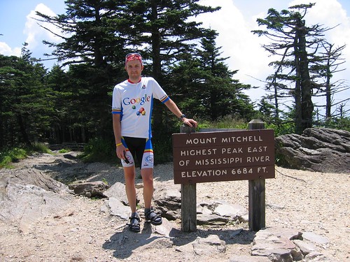
A few days after riding Clingman’s Dome (the highest point in Tennessee) I rode Mt. Mitchell (the highest point in North Carolina). That was four years ago today. The bulk of the climb was quite similar to Clingman’s Dome: not very steep, winding roads, not much traffic. However, Mt. Mitchell threw in a few surprises that made it quite a bit more challenging.

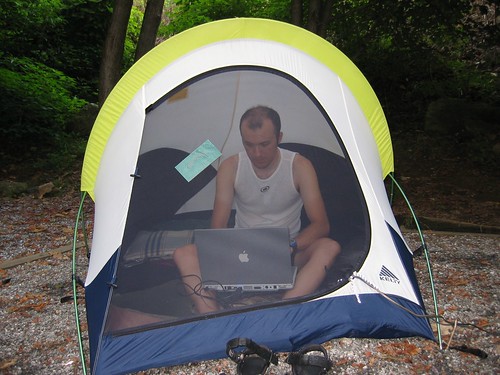
Rob computing

Just outside of Asheville, NC we turned onto the fabled Blue Ridge Parkway. This is a 500 mile scenic drive (no commercial traffic allowed) through east-central Appalachia. Once again, I rode my trusty Thundercougarfalconbird, while Melissa drove Iris the support vehicle. The road turned upward immediately as I rode away from Asheville.

Blue Ridge Parkway

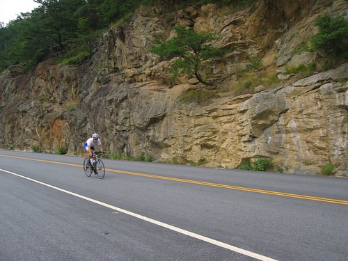
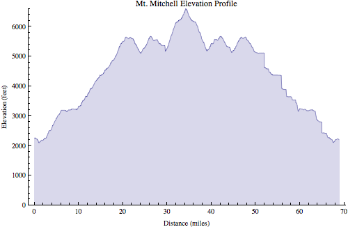
The first few hours (yes, hours) went smoothly. This part of the climb was not very steep. I settled into a steady pace. This climb (35 miles) was much longer than the two other mountains I had previously ridden, Clingman’s dome (20 miles), and Mt. Tam (10 miles). To put it in comparison, it dwarfs the climbs typically done in professional bike races (where 10 miles is a long climb, and virtually no climbs are longer than 12-15 miles). Of course, it wasn’t that steep though. Yet.
Mt. Mitchell

Around 5,000 ft altitude I noticed for the first time it was actually much more difficult to breathe. Around 5,500 ft I encountered a fairly long downhill section which caused me more worry than relief. Every inch I descended would be another inch I would have to climb again to reach the top. Before long the road went up again. Then back down again. Crap.
Mt. Mitchell

Finally, I reached the turn off of the Blue Ridge Parkway into Mt. Mitchell state park. This is where things got interesting. The road immediately hit 9% and stayed that way for 1.5 miles or so. After hours of climbing a moderate grade, this steep section really hurt. Fortunately, the top was very near, and I made it without incident.

Mt. Mitchell

Mt. Mitchell

After a brief rest at the top came the fun part: 35 miles downhill (well, except for those two stupid dips which I had to ride up on the way back).

Mt. Mitchell descent

At one point I noticed a few cars backed up in the road, so I had to slow down. I wondered what was going on. There was nothing blocking the road so I gently eased around the stopped cars and continued on my way. As soon as I reached the front of the group I looked over to my right and noticed about 20 meters away from me was a bear walking along the side of the road. I coasted along as I stared at it, not believing my eyes. I was used to seeing dogs while cycling, maybe even deer, but this was a first for me. Anyway, I quickly came to my senses and hauled ass out of there. I had no desire to become this bear’s lunch.

Mt. Mitchell map

Mt Mitchell profile

Ride Information
Date: 2005-08-11 8:50 AM EDT
Mountain: Mt. Mitchell
Road Elevation: 6585 feet
Climb Distance: 34.25 miles
Climb Ascent: 5956 feet
Climb Average Grade: 4.3%
Climb Maximum Grade: 9%
Ride Distance: 69.9 miles
Ride Total Ascent: 7472 feet
Ride Maximum Speed: 48 miles/hour
Ride Start: Asheville, NC (2194 feet)
Ride End: Asheville, NC (2194 feet)

The Highest Point in Tennessee

I enjoy cycling. Long time readers might recall that a long term goal of mine is to cycle to the highest point (well, highest paved road) in every U.S. state. The first one I checked off the list was Tennessee, four years ago today.

Living most of my life in flat, flat central Illinois I have a special appreciation for mountains. The first mountain I rode was Mt. Tam in California, in 2004. I rode it again in 2005, at which point I was hooked. I needed more mountains, but I had none near home. So I started looking around for places where I could take trips to ride mountains.

Having spent every summer during college working in central Appalachia I was somewhat familiar with this mountain range, plus it’s an easy day’s drive to get there. But where to go. If I was going to take a special trip I wanted some big, big mountains. The two biggest are Mt. Mitchell (6,684 feet, the highest point in North Carolina, near Asheville, also the highest point east of the Mississippi river), and nearby Clingman’s Dome (6,643 feet, on the TN/NC border, the highest point in Tennessee).

Iris packed for vacation

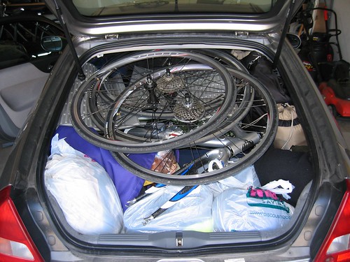
What started out as kind of pie-in-the-sky wishful thinking quickly turned into a week-long family vacation in August 2005 (i.e. best vacation ever®). We packed the Insight full of camping gear, food, clothes, and two (yes, two) bikes and headed to the Great Smoky Mountains National Park.

Camping at Great Smoky Mountains National Park

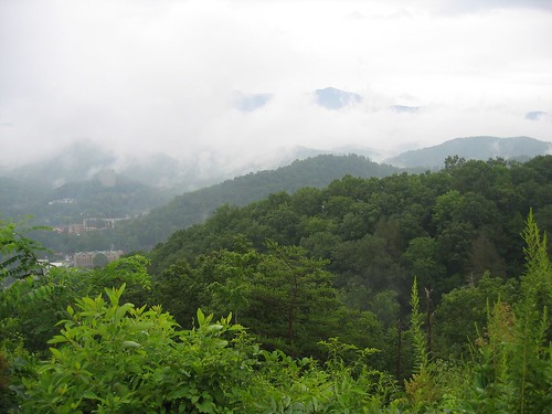
We camped in the park (just outside of Gatlinburg, TN) the first night and woke up bright and early, ready to tackle Clingman’s Dome: me on the bike, my wonderful wife driving the support vehicle. The ascent was 20 miles long and rose around 5,000 ft. The road wasn’t terribly steep (4-5%) since it was in the national park and it was built so RV’s could make it up.

View of Gatlinburg, TN

The first mile or two was very easy. I was cruising along at 16-17 mph thinking this will be a piece of cake. The gradient increased gradually until I was closer to 8-10 mph, where I would remain for most of the climb. I didn’t know what to expect with such a long climb (twice as long as the only other mountain I had climbed), and since I have a double chainring I switched to a mountain bike cassette with a 32-tooth cog before the ride. I could have gotten by comfortably with a 28. My regular road cassette only had a 25. This would have been usable, but much more difficult.

Clingman's dome

The first 12.5 miles on Newfound Gap Road had just a little bit of traffic, but it wasn’t bad. All the cars were going very slowly anyway, so my presence didn’t seem to cause any problems.

Newfound Gap

At Newfound Gap I stopped to get new water bottles from Melissa, then turned off onto Clingman’s Dome Road for the final 7.5 miles. There was very little traffic on this road. Aside from a short downhill this road was also a little bit steeper.

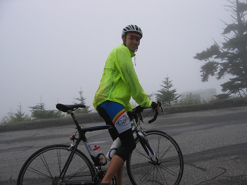
Rob at top of Clingman's Dome

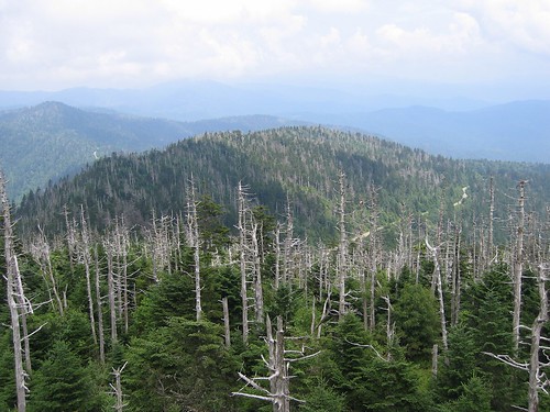
What had been foggy and overcast weather all morning turned into a light drizzle at the summit of Clingman’s Dome. Fortunately, we made another trip back there a few days later for a better view from the observation tower at the top.

View from Clingman's Dome

Appalachian Trail at Clingman's Dome

I chose to descend the other side of the mountain, into North Carolina, rather than go back down the way I came up. Like the other side, this side wasn’t terribly steep, but it did have some long straight sections that relatively safely allowed for high speeds.

Rob on Clingman's Dome descent

This was only the third time I had ridden a mountain, so my descending skills were a little lacking. Nonetheless I was able to get up to 48 mph or so on the descent.

Clingman's Dome descent

At the bottom Melissa picked me up and we drove off to the next campground where we would continue our great adventure. I really enjoyed the ride up to and back down from Clingman’s Dome. It was challenging, but not ridiculous (like Mauna Kea). It was a good warmup for Mt. Mitchell a few days later.

Clingmans Dome map

Clingmans Dome  profile

I had some GPS wonkiness that caused the square looking sections

Ride Information
Date: 2005-08-08 7:39 AM EDT
Mountain: Clingman’s Dome
Road Elevation: 6318 feet
Climb Distance: 20.0 miles
Climb Ascent: 4837 feet
Climb Average Grade: 4.8%
Climb Maximum Grade: ?
Ride Distance: 50.6 miles
Ride Total Ascent: 5895 feet
Ride Maximum Speed: 48 miles/hour
Ride Start: Elkmont Campground, GSMNP, TN (2285 feet)
Ride End: Oconaluftee Vistior Center, GSMNP, NC (2046 feet)

A I mentioned, we came back to Clingman’s dome a few days later and parked at Newfound Gap. From there Melissa & I rode together the last 7.5 miles to the top. Despite her fear, I think she really enjoyed the ride. Conquering that mountain was certainly difficult for her. She often mentions that experience in the same breath as other difficult moments in her life (i.e. marathon #1, marathon #2, marathon #3, etc.) that have helped her learn to persevere.

The Cobb Park Crit

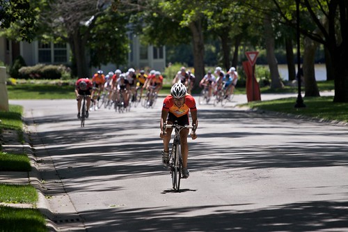
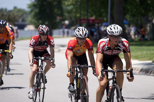
Yesterday was the Cobb Park Criterium in Kankakee. This is one of the closest bike races to Champaign-Urbana, so a lot of my Wild Card Cycling teammates participated. Unfortunately, I’ve been struggling with some knee pain the past two weeks. It finally seems to be getting better, but I definitely didn’t want to aggravate it by racing again too soon.

I still wanted to support the team so I went up to watch the category 4 race (the one I would have been riding). We had six guys in that race — Mark, Q., Chad, Thomas, Luke, and Nick. Earlier in the day Alexi, Scott, and Art rode in the cat 5 race, while Greg & Karl rode in the masters 50+ race. As with many other types of racing I’m much more accustomed to competing than spectating. I always forget how fun it is to watch friends race.

Mark jumps off the front

Chad in is first race with Wild Card

Just think how fast Luke would be without all that extra hair

Q. takes a flyer

Nick looked as cool as a cucumber the entire race

Thomas takes a flyer

One lap to go

Karl and Scott cheer on the team with one lap to go

I took a lot of photos of my friends (some of which can be seen here, or in the video below), as well as some video footage. I mounted my little Flip video camera to the hot shoe of my Canon 50D DSLR and captured video while I was taking pictures.

I planned to quickly throw together the video clips late last night and post it online. I thought it was kind of cool how the sound of my still camera’s shutter can be heard clicking in the video so I spliced in some of the still photos around the time they were taken. Once this was in place the video clearly needed a soundtrack, so I added the greatest cycling music from the greatest cycling movie (American Flyers). This took considerably more time. I finally finished around 2 a.m., but it was totally worth it.

If you can watch this without a huge smile on your face you clearly haven’t seen American Flyers enough times.

The Devil Mountain

I love bicycling up and down mountains. Ironically I live in Champaign-Urbana, IL (i.e. the flattest place on Earth). The past several times I’ve travelled to San Francisco for WWDC I have ridden Mt. Tamalpais, just to the north of the city in Marin county. I decided to mix it up a bit this year, so after the conference ended on Friday I grabbed my bike, hopped on BART, and travelled to Contra Costa county in the east bay to ride Mt. Diablo.

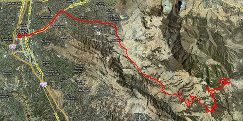
I started at the Walnut Creek BART station. From there I headed down Ygnacio Valley Road (which had a little more traffic that I was expecting). From there I turned onto Walnut Ave. (not Walnut Blvd.). I turned right at the traffic circle at Oak Grove Rd., then I took a quick left onto North Gate Rd. This leads into Mt. Diablo State Park. Before the ride I read that bikes didn’t have to pay so I blew through the park gate.

Mt Diablo map

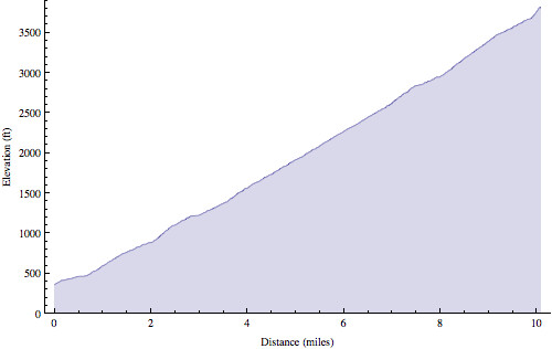
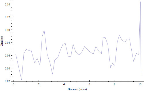
Mt. Tamalpais rises 2500 ft in around 10 miles, whereas Mt. Diablo rises 3500 ft in 10.1 miles (average 6.5% gradient). So Mt. Diablo is noticeably steeper most of the way.

Mt Diablo elevation

Mt Diablo gradient

Mt. Tamalpais has a fair amount of shade, while Mt. Diablo is almost completely out in the open. So I baked in the sun. This was somewhat unexpected, as the weather had been 60˚ F and overcast all week long in San Francisco. As soon as I left the city the temperature was much, much hotter.

Traffic was light. I think I saw more bikes on the road than cars. Incidentally, most of the cyclists were all decked out in cold weather gear like jackets. Meanwhile I was sweating like a hog and shedding clothes. The flies apparently liked the way I smelled, because a swarm of 6-8 of them followed me the last 6 miles of the climb.

Just like both the West and East peaks of Mt. Tamalpais, the road up Mt. Diablo throws in a 16% gradient to just before cresting the summit, though this steepest section on Mt. Diablo was much longer. I was afraid to stop for fear that I wouldn’t be able to get started again. It was that steep.

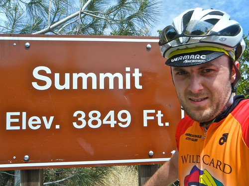
Rob at summit of Mt. Diablo

A very sweaty Rob at the summit of Mt. Diablo

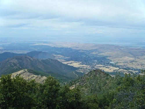
The views were spectacular the whole way up. The lack of trees (and guardrails) allowed an unobstructed view. The view from the top did not disappoint either. I could see miles in all directions. I couldn’t quite see San Francisco. I think there was a shorter range of mountains/hills between Mt. Diablo and the city that blocked the view.

View from summit of Mt. Diablo

view to the north from the summit of Mt. Diablo

The ride down was super fast (well above the posted 25 mph speed limit). I recorded the whole thing with my Flip video camera. Here it is at 5X speed.

Anyway, the ride was awesome. I’m a little sad I didn’t get a chance to ride Mt. Tam also, but maybe I’ll do that next year.

Ride Information
Date: 2009-06-12 1:33 PM PDT
Mountain: Mt. Diablo
Road Elevation: 3849 feet
Climb Distance: 10.1 miles
Climb Ascent: 3471 feet
Climb Average Grade: 6.5%
Climb Maximum Grade: 16%
Ride Distance: 32.75 miles
Ride Total Ascent: 4400 feet
Ride Maximum Speed: 35.9 miles/hour
Ride Start: Walnut Creek, CA (200 feet)
Ride End: Walnut Creek, CA (200 feet)

The Cable Car Museum

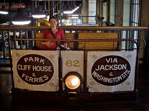
As Melissa mentioned we visited the Cable Car Museum on Saturday. It was relatively small and easy to take in, but quite fascinating at the same time. The fairly primitive technology behind the cable cars is remarkably clever.

Melissa & Fig at the Cable Car Museum

Melissa & Fig at the Cable Car Museum

There are three operating cable car routes in San Francisco (California, Powell-Hyde, & Powell-Mason), but there are four separate lines (California, Powell, Hyde, & Mason). The museum lies roughly in the middle of these four lines. In addition to the cable car museum, this building also houses the motors and pulleys that actually operate the cable cars.

Motors pull the cable cars

510 HP electric motors pull four steel cables (three pictured) at 9.5 mph, bearing the load of every cable car in the city

Cable & grip

This display shows how the grip clamps onto the cable under the street.

Motors motors keep the wheels turning. A system of large underground pulleys allow the cables to turn corners.

The Bell Ringing Contest

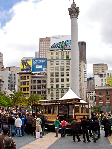
We arrived in San Francisco last Sunday. When we took our first cable car ride of the trip that evening I noticed signs everywhere advertising the 47th Annual Cable Car Bell Ringing Contest. I thought nothing of it. I met up with Melissa & Laura for lunch on Tuesday right when the contest was taking place a short distance away at Union Square… so we grabbed some lunch to go and watched the bell ringing contest.

Union Square

Cable Car bell ringing contest at Union Square

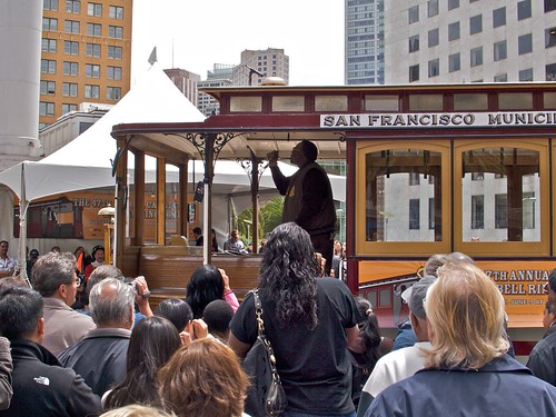
When we first arrived the amateurs had already started, and let’s just say it wasn’t quite what we were expecting. Fortunately, the professionals (actual MUNI cable car employees) started soon and they were much better. Granted, there’s only a certain level of creativity one can express with a single bell, but it was all good fun.

Bell ringer

The pros show how it’s done

The Twin Peaks

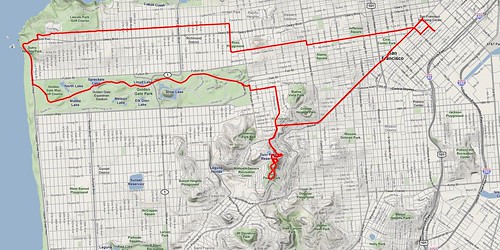
On my 6 a.m. bike ride this morning I headed towards Golden Gate park. When I reached Market & Castro the “bike route” split off from Market up this hill, so I continued up the hill. I reached the top at an intersection. To the left it continued to go up, so I turned left. A few turns later, after a mile and a half climbing at 10% gradient, I found myself at the top of Twin Peaks (nearly the highest point in the city). Even though the air was hazy the view was spectacular.

San Francisco panorama

San Francisco panorama

Market Street

Market Street & downtown

You can see this hill from anywhere in the city, but for some reason I always assumed the top wasn’t publicly accessible so I never tried to ride up before.

After descending the hill I rode through Haight-Ashbury, Golden Gate Park, along the Pacific coast, then back downtown.

TwinPeaks ride map

ride map

TwinPeaks ride elevation profile

ride elevation profile