Where I come from we don’t forget about hills like that

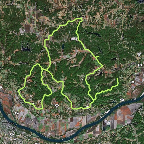
So it’s no secret that our former hometown of Champaign-Urbana is the flattest place on Earth. For a long time I assumed most of the midwest was similar, but it most certainly isn’t. Last Sunday I did a 50 mile ride with my friends Nick & Mike, along with a new guy Kurt (or is it Curt?) who showed us a heck of a route about a half hour west of the city.

Screen shot 2010-11-03 at 10.08.14 PM.png

We started at Matson Hill Park (any hill with a name earns my immediate respect), near Defiance, MO. Traffic was relatively light, which was a welcome change from the city. There were 10 or so good hard climbs in the 200-400 foot range, many of which were extremely steep, a few were in excess of 20%. These suckers were tough.

Screen shot 2010-11-03 at 10.08.46 PM.png

Aside from the big hills the route had rolling hills that dwarf anything in Champaign County almost non-stop the entire way. As we approached one of the big hills Kurt turned to the rest of us (who had never seen this route before) and said:

Oh… I forgot about this hill.

He then beat me to the top rather handily. When I eventually caught back up with him the only response I could muster was:

Where I come from we don’t forget about hills like that.

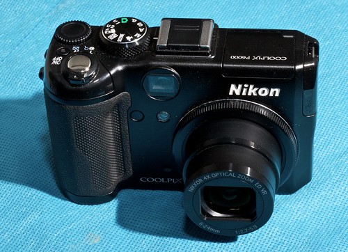
The P6000

Last November I was very happy with my Canon 50D purchase. Melissa was a little stunned and confused when I started toying around with the idea of getting another new camera. I was taking more and more photos I wanted a little point and shoot camera I could take with me everywhere. I shopped around a lot and eventually settled on the Nikon P6000.

Has it lived up to my expectations?

Yes.

And no.

Nikon P6000

Let’s start with the pros. The P6000 is smaller and more portable than my than my DSLR, so I was able to take it with me more often than the 50D. The quality of photos is excellent. It’s not DSLR quality, but it’s better than any other point and shoot camera I’ve used.

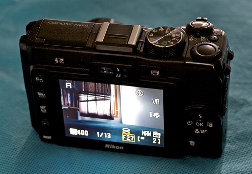
Like DSLRs, it can shoot in RAW format, which I have used with this camera exclusively. This allows for better control when making adjustments (things like exposure, brightness, etc) on the computer after the fact.

It has built-in GPS. This was a big feature for me. It automatically embeds latitude/longitude when a photo is captured so I can later find the exact location where the photo was taken. This is the first mainstream consumer camera to have this feature, though it won’t be the last. This is such a wonderful feature it will only take a few years until cameras have it.

It has a built-in time lapse mode. Again, this is another feature so fantastic all cameras will come with it in the future. In fact, how is this not standard already?

Nikon P6000

Now on to the cons. It’s big. Well, it’s all relative I suppose. The primary reason I got this camera was I thought it would be small and I could take it with me everywhere. It’s somewhat small, but not small enough to take everywhere. It easily fits in a jacket pocket, but not as well in pants/shorts pocket. It also has enough weight to it that it pulls on the pocket noticeably. For most people this wouldn’t be a problem, but I was riding my bike with it every day and it just wasn’t ideal.

Next, GPS. Wait, didn’t I list that under the pros section? Yes. For you see, this is a wonderful feature, but the GPS in this particular camera doesn’t work as well as it should. Even with a perfectly clear, unobstructed view of the sky it takes a very long time to acquire a fix on the GPS satellites — at least a minute or so. That means even in perfect conditions for GPS you can’t just take the camera out, turn it on, snap a photo, and have GPS data embedded. The only way to get the GPS data is to take the camera out and turn it on well ahead of time, wait, wait, snap a photo, leave the camera on (because you don’t want to have to wait around again next time). I got it working sometimes, but it was a hassle. Next, when conditions were not ideal (i.e. obstructed view of sky, like in a forest) the GPS didn’t work at all. I tried several times in the forest and could not get signal no matter how long I waited. Grrrrrr.

The camera has a built-in ethernet jack. It works… so why is this a con? Because it’s a completely useless feature. Practically speaking it can only be used when your computer is nearby (in which case you could just as easily plug it into the computer). If it had wireless, rather than wired, networking perhaps someone might actually use it.

Finally, the battery life is quite poor (by my standards). This is probably mostly due to the GPS. When I was using this camera every day I had to charge it every other day, even with light use (only a couple photos per day).

These things said, it’s still a good camera… but I no longer use it. I have since purchased a smaller, lighter, (waterproof even) point and shoot camera which does not have GPS or take quite as good photos as the P6000… but I truly can take it with me everywhere.

This camera just wasn’t right for me. It could be right for other people though. If you want a high quality point and shoot camera, and you’re not concerned with ultimate mobility, and you accept the fact that the GPS is a nice bonus for the camera rather than a true selling point, I would have no problem recommending this camera. Anyone want to buy mine?

Anyway, here’s a few of my favorites from this camera:
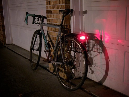
Commute

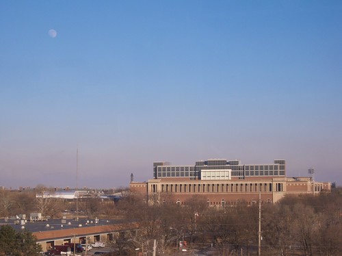
Moon over Memorial Stadium

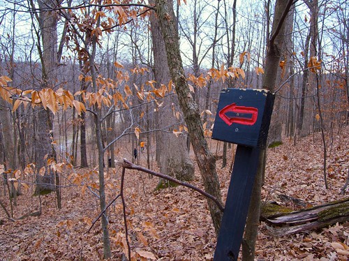
Red arrows mark the trail

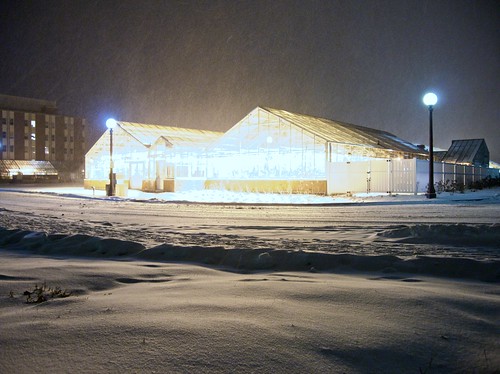
Greenhouse

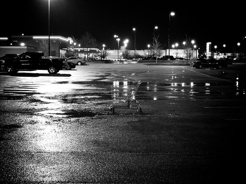
The lonliest cart

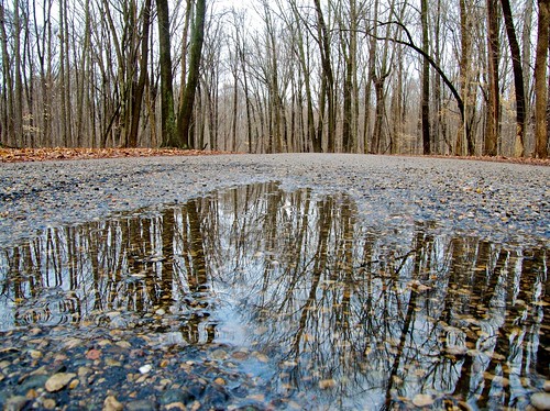
Puddle

Rob & Melissa say goodbye to Iris

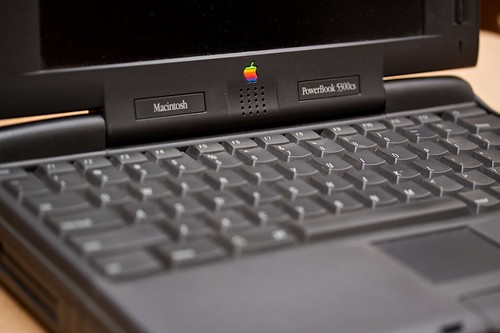
The PowerBook 5300cs

For many years I acquired (either inexpensively or freely) a lot of computer parts and other miscellaneous electronic equipment. I’ve been hanging on to these things just in case I ever needed to use them.

I never needed to use them.

A lot of this stuff was sitting around for years at our old house. Then it was put into storage when we moved to Nicaragua. Then it was moved into our new house. Close to two years later it still hasn’t been used. So it’s time we parted ways.

Today was the annual free electronics recycling event in Champaign-Urbana. Over the past few weeks I’ve been cleaning out my office so I could take this stuff to be recycled.

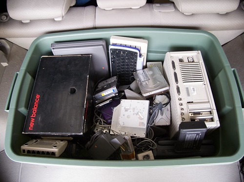
Box of electronics for recycling

The large box of items I took for recycling included:

  • 1 desktop computer (a Mac IIci)
  • 2 laptop computers (a PowerBook 5300cs and a PowerBook Duo 250)
  • 3 PDAs (including 1 smartphone)
  • 2 keyboards
  • 2 ISA-slot modem cards
  • numerous hard drives (all erased, one with a hammer)
  • more obsolete cables and connecters than you can imagine

You get the idea.

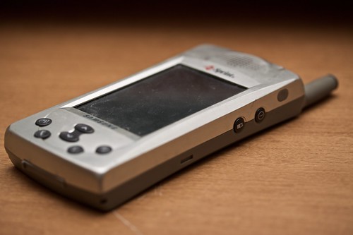
Of note, the box contained my first PDA (a Palm iii) and my first smartphone (a Samsung SPH-I300).

Samsung SPH-I300

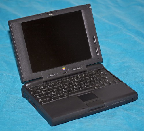
The most sentimentally valuable obsolete item in the box was my old PowerBook 5300cs. This was my second computer and my first laptop. I got it in the fall of 1996 and used it regularly until the fall of 2000, when its duties were usurped by my work-issued PowerBook G3.

PowerBook 5300cs

Everyone has a laptop now, but in 1996 it was somewhat rare. I took it to most of my college classes to take notes (I can type way faster than I can write). Being the only person with a laptop in a lecture hall with hundreds of students meant that I stood out like a sore thumb, but I didn’t particularly care.

PowerBook 5300cs

One funny story about this laptop occurred in the summer of 1998. I was finishing up coursework for my Math 285 class (differential equations) while I was working for ASP in southeastern Kentucky. I must have tripped over the power cord or something, because the power connector inside the laptop broke off from the motherboard. I had course work that had to be completed (using Mathematica, on my laptop) by a certain date… and I had about two hours of battery left and no way to recharge the battery.

I used what precious little battery power I had left to connect my external modem to the internet via a long distance phone call. I shopped online for 20-30 minutes until I found a replacement part that would solve my dilemma (an expansion bay power supply). I ordered it and received it a few days later via FedEx. I completed my work and received an A in the class.

This computer and I have been through a lot together.

The Domestic Travels

I enjoy traveling, and I love geography, so I was very excited when a friend of mine recently mentioned this website that allows people to track their travels, county by county, across the country. I spent a couple hours entering my data (thanks to some helpful information from my dad regarding trip routes from my childhood) and now I have this wonderful map.

Click to enlarge

I categorized the counties thusly:

In cyan (light blue) are places where I’ve traveled in an automobile (or other motorized land vehicle). These include:

  • Seattle/Olympic National Park
  • Silicon Valley
  • Grand Canyon
  • El Paso/Juarez
  • Dallas
  • Galveston
  • New Orleans/Baton Rouge
  • Nashville
  • Des Moines
  • Minneapolis
  • Green Bay
  • Sault Ste. Marie
  • Cedar Point/Sandusky
  • Washington DC
  • Wilmington, NC
  • Hilton Head, SC/Savannah, GA
  • Hawaii & Kauai islands
  • Most of Illinois, Indiana, and central Appalachia
  • Everything along the way to these places

In magenta (light purple) are places where I’ve been bicycling (and probably travelled by auto also). These include:

In dark blue are places where I’ve been, but only in the airport (i.e. I had a layover there). These include:

  • Los Angeles
  • Phoenix
  • Salt Lake City
  • Kansas City
  • Atlanta
  • Miami
  • Honolulu

It’s exciting to remember all the great places I’ve been, and just as exciting to think about all the places I have yet to explore. I’ve still never set foot in 19 states:

  • Maine
  • New Hampshire
  • Vermont
  • Massachusetts
  • Rhode Island
  • Connecticut
  • New York
  • New Jersey
  • Delaware
  • Alabama
  • Nebraska
  • South Dakota
  • North Dakota
  • Colorado
  • Wyoming
  • Montana
  • Idaho
  • Nevada
  • Alaska

I’ve got places to go. Hopefully I will keep the map updated along the way.

The Overpass to Nowhere

I was just reading an email on the ChampaignCountyBikes.org mailing list that discussed the possibility of building a new overpass on a county road over some railroad tracks. I’m not all that familiar with the area in question, so I can’t really say whether it would be a worthwhile project. The email did include a figure that I’ve been wondering about for a few years. Apparently the cost to build such an overpass is estimated at $9,700,000.

9.7. Million. Dollars.

The reason I’ve wondered is because a few years back I came across the most bewildering sight while bicycling by myself just north of Mansfield, Illinois. I was in the absolute middle of nowhere and I passed a small county road with an overpass over a set of railroad tracks. Every other road had level crossings over these tracks, including some with way more traffic (though still not much). Why on earth would this one particular road, with little-to-no traffic, have an overpass? Why would some governing body waste millions of (presumably taxpayer) dollars on such an overpass to nowhere?

Below is a map of the overpass. If you can determine why it’s there, I’d sure like to know.

View Larger Map

The World, Re-Justified

I just came across this web site describing The World, Justified, a piece of (ASCII) art created by a couple of Brazilians. Very interesting idea. I was able to replicate it using Mathematica 6 in just a few lines of code.

In[1]:=

map = CountryData[“World”, {“Shape”, “Equirectangular”}]

Out[1]=

In[2]:=

g = Rasterize[map, ImageSize→80]

Out[2]=

In[3]:=

raster = First @ Cases[g, _Raster, ∞] ;

In[4]:=

txt = Reverse @ First[raster]/.{ {255, 255, 255} →” “, {_, _, _} →”*”} ;

In[5]:=

CellPrint @ Cell[StringJoin @@ Riffle[StringJoin/@txt, “\n”], FontFamily→”Courier”]

In[6]:=

CellPrint @ Cell[StringJoin @@ Riffle[StringReplace[#, ” “→””] &/@txt, “\n”], TextAlignment→Left, FontFamily→”Courier”]

In[7]:=

CellPrint @ Cell[StringJoin @@ Riffle[StringReplace[#, ” “→””] &/@txt, “\n”], TextAlignment→Right, FontFamily→”Courier”]

In[8]:=

CellPrint @ Cell[StringJoin @@ Riffle[StringReplace[#, ” “→””] &/@txt, “\n”], TextAlignment→Center, FontFamily→”Courier”]

The Geoffender

You read me my rights and then you said “Let’s go” and nothing more.

Blondie (as covered by The Mr. T Experience).

The Iron Coder competition from the recent C4[2] conference I attended had a required API (iPhone OS’s CoreLocation) and a theme (paranoia). I actually did take a couple hours on Sunday morning to throw together a submission. Sure, it wasn’t going to be polished, but still creative perhaps. I figured several people would do something like a crime map. I tried a variant on that, dealing only with one (particularly nasty) type of crime.

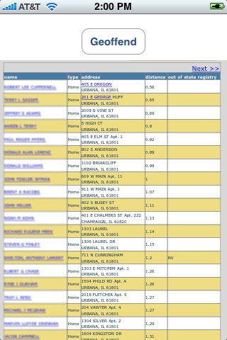
The app I threw together is quite simple. You press the “Geoffend” button. The app determines your location from the iPhone’s built in GPS. The app fetches from the internet and displays a list of registered sex offenders who live near your current location. If that doesn’t induce paranoia, I don’t know what will. I call it Geoffender (combining Geo with offender).

I got the app working in the iPhone simulator on my computer, but I ran into problems running the app on my actual iPhone hardware. I recently acquired a new iPhone, and I hadn’t yet set it up for development. When I tried to set it up before the contest I absolutely could not get it working. I tried everything. The iPhone platform is pretty well locked down. In order to do development you have to have various digital certificates and keys from Apple. I have these. The problem is installing them correctly is not completely straightforward. So the demo was a no go.

It’s just as well. There were many other submissions to the contest which were much better. I also learned a few things, so the time wasn’t wasted.

The Mountain

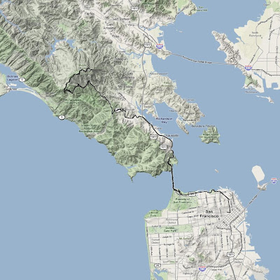
While in San Francisco a couple weeks ago I spent one afternoon riding Mt. Tamalpais. Mt. Tam is probably the closest mountain to San Francisco, located about 20 miles north of the city in Marin County. This was the fourth time I’ve ridden it and it holds a special place in my heart as the first mountain I ever rode on a bicycle.

I started in downtown San Francisco and made my way out of the city, over the Golden Gate Bridge (which I rode 5 times during the trip). It was so foggy that day I literally couldn’t even see the bridge until I was on it. As I was approaching the bridge I passed two tourists on rental bikes intently studying a map, looking around, and pointing different directions. As I passed I called out to them, “Are you looking for the bridge?” They replied, “Yes.” I responded, “It’s this way.” I have been there several times before, but no matter where I travel I always seem to be the one who gives directions to other tourists, despite the fact that I don’t actually live in these places.

Once over the bridge there is a nice little descent into Sausalito. There are a lot of bikes in this area as well. One of the popular routes for tourists on rental bikes is to cross the bridge to Sausalito, then take a ferry back to San Francisco rather than ride back (it’s a little hillier than the average tourist can handle). The route to Mt. Tam follows the bay for a few miles before shooting inland.

Mt. Tam is a little over 2500 ft high. The main climb is 10 miles long and averages around 5% gradient (though this includes a few downhill sections, it’s mostly steeper than that). It starts on a very curvy section California Highway 1 at Tamalpais Valley Junction, just slightly above sea level. These first two miles can have a fair amount of traffic, depending on the time of day. Fortunately, this road is also heavily travelled by bicycles, so nearly all the cars behave sensibly when they encounter a bike. There wasn’t a whole lot of traffic on the afternoon I chose.

After turning off California Highway 1, there really wasn’t much traffic for the remaining 8 miles. Once I reached about 1200 ft of elevation I broke through the fog & clouds and it was perfectly clear and sunny. In fact, once I got to about 1600 ft the sun was absolutely blistering. I was sweating profusely and going through water like it was… er, water. I even got sunburned. This was not what I was expecting when I left town, given I could only see a couple blocks ahead of me.

I had been looking forward to this ride literally for months, so you can imagine how I was feeling when halfway up I entered Mt. Tam State Park and saw this:

Audrey, when they close the road they put up big signs, like this one

I was pretty devastated. I stopped riding and walked across the road to the ranger station. I found a map and started to plan the remainder of my ride (I still had a few hours to kill). Maybe I wouldn’t get to ride all the way to the top, but I would still try to find somewhere interesting to go. As I was standing there I overheard a couple of hikers chatting with the ranger. The ranger was telling them it was okay for them to go hiking up on the mountain. Hmmm. After they left I walked over to the ranger and asked about biking. I was delighted to hear that the road was only closed to automobiles, and bikes were quite welcome to continue up the road. So I can just walk around the gate and keep riding? Apparently.

This turned out to be a blessing in disguise because there was no auto traffic on the road for the last half of the ride. I was basically all by myself (well, there were some horseflies).

From 1800 ft I could look down at the clouds rolling in from the Pacific

From 2500 ft (west peak) I could see the downtown skyscrapers over the clouds

Mt. Tam has three peaks (west, middle, east). The east peak is the highest, though the road doesn’t go all the way to the top. The west peak is slightly lower, but the elevation of the road is the highest there (a little over 2500 ft). The two steepest and hardest sections of the entire ride are right as you reach the east peak and right as you reach the west peak. Go figure.

The Pocket Rocket at the east peak

At the top I filled my water bottles and ate a couple Clif Bars. There was a soda machine which appeared to have cold lemonade for $1, which sounded perfect. I reached for my wallet only to discover a lone $20 bill. Damn. I made due with water.

Now the hard work was over, it was time to coast for 40 minutes (okay, there were a few small uphill sections on the descent). The first 8 miles of descent were traffic free. About a quarter mile after turning onto Highway 1 I caught up with a car (yes, I was going significantly faster than the cars downhill) and had to follow it the remainder of the way down (there was no room to pass). I broke my $20 bill for a bottle of Gatorade at a gas station at the bottom of the descent. Then I made my way back to the city.

What a great ride. The best part was seeing how well my little Pocket Rocket held up. Not only was it great at climbing, it handled amazingly well at around 40 mph on the descent. It truly is a no compromises travel bike.

I got one last view of Mt. Tam as I was flying out of the San Francisco airport. If you follow the wing all the way to the end, then look up you can see Mt. Tam.

Ride Information
Date: 2008-06-13 1:24 PM PDT
Mountain: Mt. Tamalpais
Road Elevation: 2492 feet
Climb Distance: 10.0 miles
Climb Ascent: 2492 feet
Climb Average Grade: 4.7%
Climb Maximum Grade: 20%
Ride Distance: 49.5 miles
Ride Total Ascent: 5685 feet
Ride Maximum Speed: 37.4 miles/hour
Ride Start: San Francisco, CA (0 feet)
Ride End: San Francisco, CA (0 feet)

The Telegraph Hill

On Wednesday morning I headed out towards the Golden Gate bridge for a bike ride. I headed north on Kearny intending to turn left onto Columbus when I saw a monster hill. Kearny St. headed up Telegraph Hill is steep. It is closed to auto traffic. I tried to ride up this street on the Dahon a few years ago, but after slowing to a complete stop I had to get off and walk the bike the rest of the way. This time I was on the Pocket Rocket, so I figured I’d give it another go. It was still steep, but I made it without too much difficulty (though I’m kind of glad it was only one block long). From there I was close to half way up Telegraph Hill and I had never been to the top, so I figured why not go the rest of the way.

Coit Tower is at the top. This was built as a memorial to the firefighters who died in the 1906 earthquake fire. It is an impressive building, and Telegraph hill provides beautiful views of the city.

Coit Tower

San Francisco from Telegraph Hill

San Francisco from Telegraph Hill

A statue of Columbus is in front of Coit Tower. Alcatraz can be seen in the background.

Lombard St. from Telegraph Hill towards the crooked section at the top of Russian Hill

The Landprint

Z Corp, a company who partners with my employer, recently launched a new online printing service called Landprint to create 3D maps of user selected regions of planet Earth. The full topography is printed in 3D and colored to match satellite photos.

I love maps, so I couldn’t pass up the opportunity to try this out. The choice of locations was clear–my former home, Ometepe island in Nicaragua.

Landprint of Ometepe island in Nicaragua

Profile view of the Landprint

Here’s my hand for scale. It’s kind of small.

It’s made of a hard sturdy resin. I knew it was going to be small, but I underestimated just how small 4″ was. That’s okay, because the thing is really neat. They make objects slightly larger but they get prohibitively expensive pretty quick. The 4″ model was priced closer to the impulse buy range.