August 2012

Running

Howl at the Moon

August was consumed by tapering for Howl at the Moon, running Howl at the Moon, and recovering from Howl at the Moon. Over half of my miles in August came in that one day. The rest of my runs were very short, but the average distance per run was heavily skewed by Howl. My knees took a real beating during the last 10 miles of that race, so I’ve been super cautious with my recovery to ensure I don’t have any long-lasting injuries as a result.

Month Distance # Workouts Avg per Workout
January 78.06 Mile 9 8.67333 Mile
February 75.2586 Mile 9 8.36206 Mile
March 126.15 Mile 14 9.01071 Mile
April 146.28 Mile 16 9.1425 Mile
May 166.75 Mile 18 9.26389 Mile
June 54.83 Mile 7 7.83286 Mile
July 115.76 Mile 9 12.8622 Mile
August 91.81 Mile 9 10.2011 Mile
Total 854.899 Mile 91 9.39449 Mile

Running 2012 8


Cycling

Team & race volunteers

The weird thing about my knee pains is that while I have recovered reasonably well with respect to running, I can’t say the same about cycling. 10 days after Howl I went to my regular Tuesday night practice race and by the end my knee was killing me. I took another week off of cycling. The next week I intended to go back but I didn’t make it 2 miles from home before my knee started to hurt. I took 2 more weeks off of cycling. At this point I’ve only done one serious ride in the past 6 weeks, and that one didn’t go well at all. Now that road racing season is over I can just wait this thing out and make sure it’s gone before starting up in earnest again. I’d like to do some cyclocross racing this fall, so hopefully I’m back to 100% soon.

Bike Distance # Rides Avg per Ride
Pocket Rocket 18.7 Mile 5 3.74 Mile
Thundercougarfalconbird 63.17 Mile 3 21.0567 Mile
Total 81.87 Mile 8 10.2338 Mile

Month Distance # Workouts Avg per Workout
January 25.33 Mile 2 12.665 Mile
February 40.08 Mile 3 13.36 Mile
March 213.43 Mile 20 10.6715 Mile
April 253.27 Mile 23 11.0117 Mile
May 322.147 Mile 24 13.4228 Mile
June 282.57 Mile 13 21.7362 Mile
July 260.12 Mile 16 16.2575 Mile
August 81.87 Mile 8 10.2338 Mile
Total 1478.82 Mile 109 13.5671 Mile

Cycling 2012 8


Walking/Hiking

In the pack

I made up for the lack of cycling with a bunch of walking and hiking. This doesn’t hurt my knee at all, and I’m more convinced than ever that walking/hiking is actually remarkable effective training for long/ultra distance running. It allows you to put in a lot of time on your feet, working your legs, without the impact of running.

Month Distance # Workouts Avg per Workout
January 51.53 Mile 16 3.22063 Mile
February 42.92 Mile 18 2.38444 Mile
March 41.15 Mile 14 2.93929 Mile
April 31.89 Mile 12 2.6575 Mile
May 37.5107 Mile 13 2.88544 Mile
June 39.4 Mile 18 2.18889 Mile
July 2 Mile 2 Mile
August 64.99 Mile 25 2.5996 Mile
Total 311.391 Mile 118 2.6389 Mile

Walking 2012 8


Swimming

It’s both fortunate and unfortunate that I don’t have to swim much to maintain my fitness for swimming. I just have little motivation to spend time in the pool, when I could be doing any number of things that are even more enjoyable. There’s a chance I might to one more triathlon this year, but that depends on whether my knee feels well enough to bike.

Month Distance # Workouts Avg per Workout
January 0 0 0
February 0 0 0
March 0 0 0
April 1750. Yard 2 875. Yard
May 8050. Yard 7 1150. Yard
June 4100. Yard 3 1366.67 Yard
July 2993.61 Yard 3 997.871 Yard
August 2150. Yard 3 716.667 Yard
Total 19043.6 Yard 18 1057.98 Yard

Swimming 2012 8

January – April 2012

Running

IMG 0635

Running has been going well. Extremely well. I almost hate to admit that because it probably means I will injure myself at any moment. But hopefully not. I’ve been focusing a lot on my form as I try to transition to a forefoot strike pattern (rather than a heel-strike pattern). It’s hard to try to correct 18 years of bad form. Really hard. But I’m making progress. I ran farther in April 2012 than I did in any other month in the last 10 years, and I haven’t had a hint of knee pain. Of course, some of that has come at the expense of really sore calves on account of using different muscles that are much less well developed. I’ll take sore calves for a few hours over semi-permanent knee pain 10 times out of 10.

I found a great place to run barefoot: the glorious artificial turf on the WUSTL track infield (some people might call it a football field). Of the 146 miles I ran in April, 19 of them were completely barefoot, and some of those were pretty fast (5:32). The majority of the remaining miles were in my wonderful new Luna Sandals (yes, sandals), with the rest in my Vibram FiveFinger Bikilas, Merrell Trail Gloves, and New Balance MT 110s. I guess I have something of a shoe fetish (yet I still run barefoot). I just pick the thinnest shoes I can get away with based on the route I have in mind, and take them off whenever I can.

Month Distance # Workouts Avg per Workout
January 78.06 Mile 9 8.67333 Mile
February 75.2586 Mile 9 8.36206 Mile
March 126.15 Mile 14 9.01071 Mile
April 146.28 Mile 16 9.1425 Mile
Total 425.749 Mile 48 8.86976 Mile

Running 2012 4


Cycling

IMG_4020

Photo by Jeff Schleicher

I’ve been a regular at the Tuesday night crits, though I did miss a couple. I’ve been lucky to get two training rides a week. Considering where I started at the beginning of this year I’ve already come a long way, but I still have a long way to go. Looking at my race results over the past year or so it’s pretty clear where my talent lies.

Single digit placings are better than double digit placings. If I want to achieve more success in cycling races I’m going to have to spend more time (which I don’t have) practicing. Or maybe blood doping.

Bike Distance # Rides Avg per Ride
Bianchi 34. Mile 9 3.77778 Mile
El Fuego 20.04 Mile 1 20.04 Mile
Lynskey 13.64 Mile 2 6.82 Mile
Pocket Rocket 27. Mile 6 4.5 Mile
Thundercougarfalconbird 158.59 Mile 5 31.718 Mile
Total 253.27 Mile 23 11.0117 Mile

Month Distance # Workouts Avg per Workout
January 25.33 Mile 2 12.665 Mile
February 40.08 Mile 3 13.36 Mile
March 213.43 Mile 20 10.6715 Mile
April 253.27 Mile 23 11.0117 Mile
Total 532.11 Mile 48 11.0856 Mile

Cycling 2012 4


Swimming

Yes, the numbers are small. I just started late in the month. What’s promising, though, is just how quickly I was able to pick this back up after months off (and if you don’t count that week in September, years off).

Month Distance # Workouts Avg per Workout
January 0 0 0
February 0 0 0
March 0 0 0
April 1750. Yard 2 875. Yard
Total 1750. Yard 2 875. Yard

Swimming 2012 4


Walking/Hiking

Month Distance # Workouts Avg per Workout
January 51.53 Mile 16 3.22063 Mile
February 42.92 Mile 18 2.38444 Mile
March 41.15 Mile 14 2.93929 Mile
April 31.89 Mile 12 2.6575 Mile
Total 167.49 Mile 60 2.7915 Mile

Walking 2012 4

The many hills of San Francisco

Last week the whole family was out in San Francisco while I attended Apple’s Worldwide Developer Conference (WWDC). This was my ninth WWDC (two in San Jose and seven in San Francisco), missing out only in 2006 when Apple held the conference in August (for some reason) the week after we moved to Nicaragua.

The conference was good, even if the ridiculously growing size does get a little more frustrating each year. The technical sessions are all covered by non-disclosure agreements, so I won’t discuss any of them (as if you cared).

The keynote (which some of you may remember I participated in back in 2005) was also good. Unfortunately, due to the size of the conference I keep showing up earlier and earlier to get in line for the keynote and I keep ending up farther and farther back in line. I showed up a little over three hours early this year. The line was nearly one mile long, and I barely squeaked into some of the back rows of the conference room filled with over 5,000 people. The new iPhone looks pretty awesome. In fact, William just bought me one for Father’s Day. Wasn’t that nice?

Will in the big city

While we were there I purposely didn’t adjust to the different time zone so I would continue wake up early to go for a ride on the Pocket Rocket each morning before the conference. The first morning I tackled Twin Peaks, which, at over 800 feet above sea level, is one of the highest points in the city. Shortly after the climb begins it kicks straight up to 17%, which was a tough first hill for someone who lives in Illinois. It stays steep for a good long three city blocks before leveling out to a more reasonable 11-12%. Of course, it was super foggy that particular morning, so I couldn’t see anything at the top. If I could have seen anything it would have looked like this (photo from last year).

Market Street

Anyway, I had to hurry straight back in order to stand in a really long line for hours. It was just eight miles with a total of 850 feet of climbing entirely in the third and fourth miles.

The next day I rode up one of the steepest hills I’ve found in the city (Kearny between Broadway and Vallejo, the road is closed to traffic). It’s somewhere in the ballpark of 25-30%. I had to lean really far forward to keep from tumbling over backward. Yes, that steep… but only for a block. After that was Telegraph Hill up to Coit Tower. This climb was used in the prologue of the Tour of California the first few years of the race.

Financial district

But that was just the first few miles. I followed the bay shoreline to the Golden Gate Bridge and rode across to the Marin Headlands. I intended to climb Hawk Hill, but the road was closed half way up so I took a detour to somewhere I’d never been before, which was amazing.

Marin

Marin

Beach

Tuesday’s ride had 2200 feet of climbing in 26 miles.

Wednesday I took a break because I felt a little twinge in my calf after Tuesday’s ride and I didn’t want to risk making it worse. Fortunately the twinge only lasted a day and by Thursday morning I was back at it. I hit Twin Peaks again, this time better prepared for the steepness. Instead of turning around there I continued on through Golden Gate Park, Ocean Beach, past the Cliff House, the Legion of Honor, the Presidio (along the bike course for the Alcatraz Triathlon I did in 2003), across the bridge to the Marin headlands, and partway up Hawk Hill before turning around and heading home. Just for kicks I rode up Russian Hill and Nob Hill on the way back through town. Russian Hill on Hyde street is 23% for a few city blocks–too steep to sit, too steep to stop (you wouldn’t be able to start back up).

City

Grade

Thursday’s ride was 2800 feet of climbing in 27 miles.

Friday I tackled Mt. Tamalpais for the Nth time. Last year I rode Mt. Diablo instead, so I was happy to be back on familiar ground. After cool weather all week it was super hot on Friday. This made the mountain that much more difficult. I doubt I made my fastest ascent of the mountain that day, but I steadily knocked out each of the 10 miles from bottom to top.

Mt. Tam may not be as high as Mt. Diablo, but it sure is a lot more scenic, offering a lot more wooded areas, as well as ocean views.

Mt Tam

Mt Tam

Mt Tam

Mt Tam view

Mt Tam view

San Francisco from the top of Mt. Tam

Bridge and Mt Tam

Here’s the opposite view: Mt. Tam from San Francisco

Friday’s ride was 4114 feet of climbing (2500 on Mt. Tam) in 50 miles.

Saturday I skipped a ride in favor of lots of walking and hiking with the family. Here’s William and me hiking the coastal trail, which was part of the run course for the Alcatraz Triathlon I did in 2003.

Two sweaty guys hiking the Coastal Trail

We all had a great trip. Check out William’s blog for lots more family photos.

The Strangest Marathon

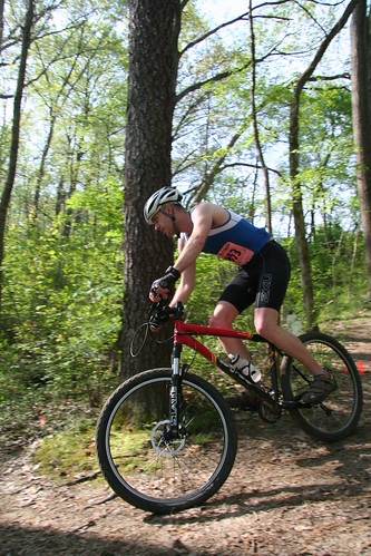
I was moving along at an easy pace. The guy in front of me had just taken a downhill section of the trail very gingerly and nearly tip-toed across a creek crossing. I passed him on the uphill section on the other side of the creek and began to pull away. Then, out of nowhere, I hit the wall. Well, not exactly. I’m not talking about the glycogen depletion “wall” where my fuel reserves have run dry. This was something entirely different and unfamiliar to me. This small incline got my heart beating so fast I was gasping for air only to find I was physically unable to maintain my modest pace. My worst fears had come true. I stopped to walk up the hill. By the time I reached the top I was seriously contemplating dropping out of the marathon.

This was at mile four.

One week prior I was in great spirits, having wrapped up my long training runs and raced fairly well at the FOLEPI River Trail Classic. I showed up at work on Monday feeling as good as possible and left work that evening with a sore throat. My throat got worse through the night and was a full blown illness by Tuesday morning. I went to work (even though I clearly shouldn’t have) only to discover my coworkers were already sick.

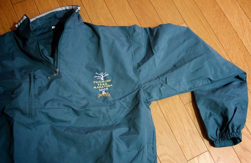
By Wednesday my throat started to get better, but the snot and sinus pain got worse. By Thursday evening I was finally starting to feel like I was getting over the sickness. I still wanted to race. I trained really hard for Tecumseh and I wasn’t going to let the sniffles take that away from me.

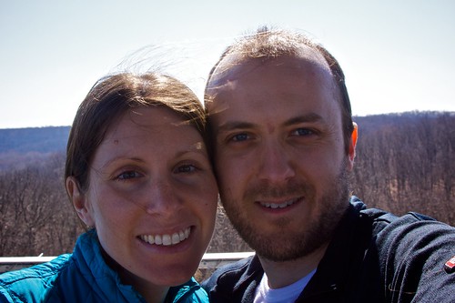
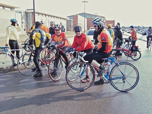
Friday I travelled to the Nashville, IN area with fellow Buffalo Ken, Brian, and Jen. We stayed at the same paintball/cabin place as last year (though with far fewer people this time). Despite feeling back to normal that morning, by Friday night I felt terrible again. Ugh.

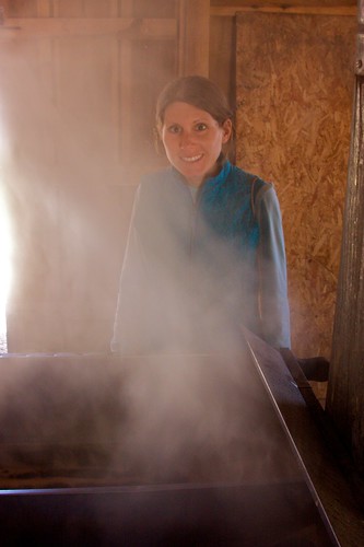
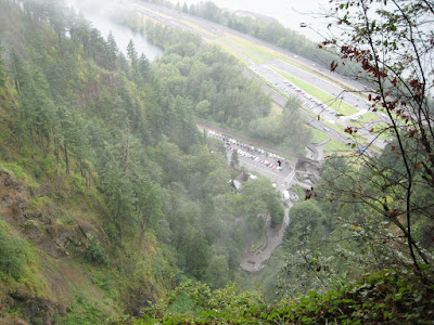
I awoke Saturday morning before the race feeling as fresh as a daisy. Whatever I had seemed to finally work its way out of my system. I thought. We drove to the race finish area, picked up our packets, and loaded up onto the buses to the starting line miles and miles away.

Tecumseh course map

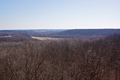
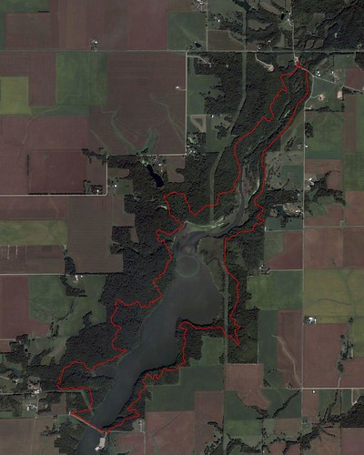
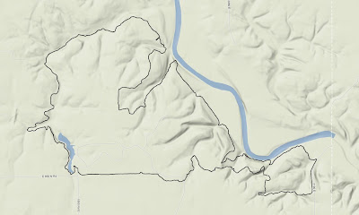
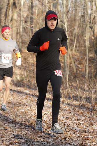
Last year I started way faster than I wanted to, but it was kind of necessary because of the congestion on the single track trail that started 2-3 miles into the race. I vowed to start off slower this year. I ran nice and easy the first mile only to look down when my GPS beeped to read 7:20. The exact same time as last year (and faster than my first mile at the Rockford Marathon where I ran my PR in May). That was the bad news. The good news was that I felt spectacular. Even though that pace felt super easy I made a conscious effort to slow down anyway. For the trail was not nearly as congested as it had been the previous year at this point. Despite the superior weather conditions (sunny rather than snow storm) everyone else was moving slower.

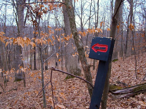
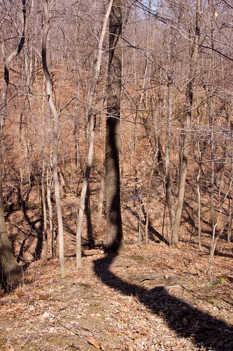
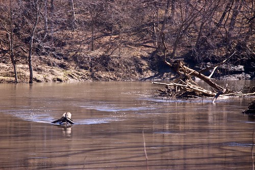
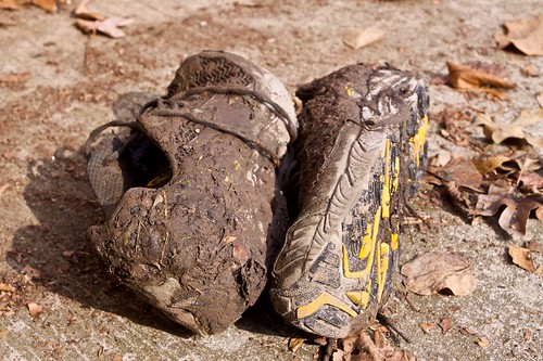
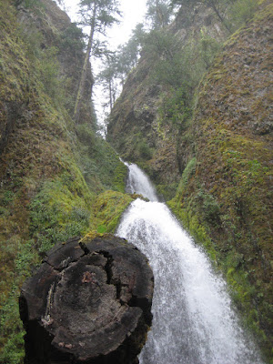
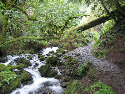
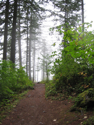
I hit the second mile at 7:29. So much for slowing down. It still felt really easy. I was barely exerting any effort. Still, I decided (once again) to consciously slow down. I hit the third mile in 7:23. Oh, come on. This was too easy. That would be the best I felt all day. We entered the single track trail through the woods, ran down a hill, over a creek, and started back up the other side when my world began to fall apart. This was not going to be my day.

After the first miserable uphill I walked I tried to shake it off and continue on like nothing had happened. I got back up to a comfortable pace on the flat sections of the course, but on the next uphill I found myself gasping for air and walking once again. If after four miles I wanted to quit, then after six miles I really wanted to quit. At this point I decided to stop racing. At the current rate I couldn’t possibly have finished. Instead I slowed down (a lot) in the hope of just dragging myself to the finish line, regardless of time or place. Tecumseh was now a training run. Or so I told myself.

Rob at Tecumseh Marathon

I ran super slow the next four miles, frequently stepping aside to let people pass me on the trail. At the 10.6 mile aid station Ken passed me. Prior to the race I was voted by the others the mostly likely to finish the fastest of our group, and as such I was entrusted with the only key to Ken’s car. Here, 16 miles from the finish and still slowing down, I quickly whipped out the key from my back pocket and handed it to Ken, who kept it for the remainder of the race.

I ate a banana at this aid station and it actually started to bring me back to life. For the first time in many miles I didn’t feel like I was about to die. Ken pulled quite some distance ahead as I walked up the next few hills. Once I got to the flat and downhill sections I just ran a comfortable pace and I actually caught back up with his pack. The thought entered my mind that I might actually be able to keep up with him until the end. Of course, the next uphill section would put that thought out of my mind and I fell behind again. But what goes up must come down and before I knew it we were together again (briefly) at the 15.8 mile aid station. We were running different races, but by not keeping up with him I had just kept up with him for five miles. We ascended once more, and once more I was alone.

Prior to this point I just felt bad for much of the race, but around miles 16-17 I actually started to get tired. I wasn’t picking my feet up, and as a result I stumbled a few times. I almost went down around mile 17, though I was able (with great determination) to stay upright. But this came at the cost of both calves, both hamstrings, and my right hip cramping at the same time while I tried to catch myself. Shaken, I walked for a bit with my head hung low. After a couple minutes I heard someone yell at me from behind, “Hey, you missed the turn.”

You have to pay attention.

I got back on the trail and started running, fighting cramping muscles. There was a big hill at mile 19, a moderate hill at mile 21, then it was mostly downhill to the finish. I got another banana in me and, again, it brought me partly back to life. I was able to pick up the pace a little and before I knew it I had caught up with and passed Ken… just in time to trip and go down. I remained on the ground long enough to work out the cramp in my calf. Then I was back up and moving quickly again.

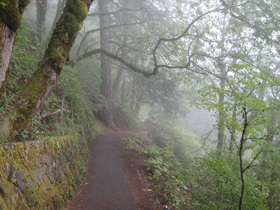
I had to concentrate really hard through a short, beautiful section of pine forest where the tree roots stuck up really far from the trail. As much as I had been dragging my feet I thought for sure I was going to hit the deck again. I didn’t.

My pace continued to increase. I wasn’t running for a faster time. I was running to get to the finish faster so I could stop running sooner. People often joke about doing exactly this, but I’m completely serious here. I took a short break to walk up the final hill with less than a mile remaining then ran all the way through the finish. Heading into the chute I caught up with a young woman who heard me cough right behind her and took off that last few meters. I congratulated her on the fast finish after the race at which point she informed me she thought my cough sounded like a woman and she really wanted to keep her top 10 finishing place. Ha!

Another 26.2

I finished in 4:20, my slowest marathon yet (by a mere two minutes). Last year, on the same course, in the snow storm, I ran 3:54. That was a really great race for me. I knew I didn’t have the fitness for the same performance again this year, but (given the better conditions) I thought for sure I would be able to equal that time. No dice.

This was a very strange race for many reasons, perhaps the strangest I’ve ever run. I felt great, then crappy, then okay, the crappy, then just fine (and so on). I ran fast, then slow, then moderate, then slow, then fast (etc). I was freezing, then comfortable, then hot, then cold, then hot, then cold. I actually ran about 8 miles wearing a single glove because my left hand was cold but my right hand was not.

The really strange thing, though, is that none of these dichotomies coincided with each other. I ran fast while feeling good. I ran fast while feeling bad. I ran slow while feeling good. I ran slow while feeling bad. I was hot while running slow. I was cold while running fast. And every other permutation of the aforementioned states.

Anyway, I wasn’t thrilled with the outcome of this race, but I did finish and I did learn some valuable lessons. Namely, you can’t run as fast when you’re sick as you can when you’re healthy, AND trying to do so will make for a fairly unpleasant experience.

The Tale of Two Trails

The Allerton Trail Race was this morning. As you may recall, I’ve been scouting the course the past two weekends.

On the 11th the course was flooded pretty badly in four places. Everywhere else the trail was muddy, but runnable. The water came right up to the edge of the trail.

On the 18th the water was a couple feet lower and there was no real flooding.

On the 25th (race day) the right height was, well, this chart speaks for itself.

Sangamon River height

The water was 3.5 feet higher than it was when there was serious flooding. Half the trail was literally under water. Fortunately, the race organizers changed the course to keep this a running race rather than a swimming race. The new course used some parts of the old trail, but added a few new parts that have never been used before.

Despite my best intentions of starting out easy, I started out fast. I quickly settled into 10th place before the end of the first mile. We crossed the big meadow where the finish line is located, but we were just getting started. The big rolling hills slowed me down, but they slowed everyone else down too. We ran back into the woods towards the minotaur before heading down a large set of stairs, only to immediately turn around and run right back up them.

A short distance later we hit water. This wasn’t a crossing, it was knee deep standing water on the trail. For 200 meters. I leaped through it only to find the trail very uneven and root-covered under the water (where I couldn’t see it). After a couple hundred meters the people in front of me finally decided it was better to run through moderately dense brush beside the trail than to brave the water any longer. I followed suit, as I’m sure did everyone behind.

With the frigid water behind my wet calves were now numb and I was running even slower. As we approached the Sun Singer I noticed the leader was heading back down the trail towards me, having already circumnavigated the Sun Singer. I thought this was peculiar because some of the race volunteers informed me that the new route included a half mile section of road… but the only road around was straight ahead (i.e. not the direction the leader was running). This meant one of two things, either my good friends gave me incorrect information, or the leader was off the course. Ugh.

As I reached the Sun Singer I witnessed a bit of chaos. A few people had run all the way around it and were now wondering where to go. The volunteers did not know. When I got half way around I noticed painted arrows on the road indicating a turn which none of the first 5-6 runners took. I was in a group of 4 who all made that turn.

Further chaos ensued about a half mile later when the 3 new leaders (who were not the original 3 leaders) continued down the road past another painted arrow on the road indicating a turn. Again, the group of 4 I was in made the turn. Suddenly I was in the lead pack. One of the runners from the lead pack (who had been off the course twice at this point) turned around and quickly caught up to us, while the others disappeared.

Here’s a (time-accurate) comparison of my 2008 (red) vs. 2009 (blue) Allerton trail race. Something funky happened with my GPS in the last half mile of the 2009 race. I didn’t cut the course, I swear!

I finished the race reasonably well. I almost caught up to the guy I had been chasing (10 meters behind) since the half mile mark. I barely edged out (by split second) a challenger from behind. I finished 5th place. I probably deserved 10th.

I have mixed feelings about the results. On the one hand, from the sportsmanship point of view, other racers deserved to finish ahead of me. On the other hand, trail racing is not like track or road racing. You really have to pay attention to the course markings. All of the turns the lead runners missed were marked. Granted, the course was new and nobody had run it before.

I won a hat for finishing 2nd in my age group. Fig seemed to like it.

Fig's new hat

The P6000

Last November I was very happy with my Canon 50D purchase. Melissa was a little stunned and confused when I started toying around with the idea of getting another new camera. I was taking more and more photos I wanted a little point and shoot camera I could take with me everywhere. I shopped around a lot and eventually settled on the Nikon P6000.

Has it lived up to my expectations?

Yes.

And no.

Nikon P6000

Let’s start with the pros. The P6000 is smaller and more portable than my than my DSLR, so I was able to take it with me more often than the 50D. The quality of photos is excellent. It’s not DSLR quality, but it’s better than any other point and shoot camera I’ve used.

Like DSLRs, it can shoot in RAW format, which I have used with this camera exclusively. This allows for better control when making adjustments (things like exposure, brightness, etc) on the computer after the fact.

It has built-in GPS. This was a big feature for me. It automatically embeds latitude/longitude when a photo is captured so I can later find the exact location where the photo was taken. This is the first mainstream consumer camera to have this feature, though it won’t be the last. This is such a wonderful feature it will only take a few years until cameras have it.

It has a built-in time lapse mode. Again, this is another feature so fantastic all cameras will come with it in the future. In fact, how is this not standard already?

Nikon P6000

Now on to the cons. It’s big. Well, it’s all relative I suppose. The primary reason I got this camera was I thought it would be small and I could take it with me everywhere. It’s somewhat small, but not small enough to take everywhere. It easily fits in a jacket pocket, but not as well in pants/shorts pocket. It also has enough weight to it that it pulls on the pocket noticeably. For most people this wouldn’t be a problem, but I was riding my bike with it every day and it just wasn’t ideal.

Next, GPS. Wait, didn’t I list that under the pros section? Yes. For you see, this is a wonderful feature, but the GPS in this particular camera doesn’t work as well as it should. Even with a perfectly clear, unobstructed view of the sky it takes a very long time to acquire a fix on the GPS satellites — at least a minute or so. That means even in perfect conditions for GPS you can’t just take the camera out, turn it on, snap a photo, and have GPS data embedded. The only way to get the GPS data is to take the camera out and turn it on well ahead of time, wait, wait, snap a photo, leave the camera on (because you don’t want to have to wait around again next time). I got it working sometimes, but it was a hassle. Next, when conditions were not ideal (i.e. obstructed view of sky, like in a forest) the GPS didn’t work at all. I tried several times in the forest and could not get signal no matter how long I waited. Grrrrrr.

The camera has a built-in ethernet jack. It works… so why is this a con? Because it’s a completely useless feature. Practically speaking it can only be used when your computer is nearby (in which case you could just as easily plug it into the computer). If it had wireless, rather than wired, networking perhaps someone might actually use it.

Finally, the battery life is quite poor (by my standards). This is probably mostly due to the GPS. When I was using this camera every day I had to charge it every other day, even with light use (only a couple photos per day).

These things said, it’s still a good camera… but I no longer use it. I have since purchased a smaller, lighter, (waterproof even) point and shoot camera which does not have GPS or take quite as good photos as the P6000… but I truly can take it with me everywhere.

This camera just wasn’t right for me. It could be right for other people though. If you want a high quality point and shoot camera, and you’re not concerned with ultimate mobility, and you accept the fact that the GPS is a nice bonus for the camera rather than a true selling point, I would have no problem recommending this camera. Anyone want to buy mine?

Anyway, here’s a few of my favorites from this camera:

Commute

Moon over Memorial Stadium

Red arrows mark the trail

Greenhouse

The lonliest cart

Puddle

Rob & Melissa say goodbye to Iris

The Forest Glen Maple Syrup

Today was the Maple Syrup Open House at Forest Glen park. The park holds this event each spring where they demonstrate how they make maple syrup and have a pancake dinner. I’ve run at Forest Glen four or five times this winter so I’ve been looking forward to this event for a while. When I told Melissa about it she was very excited, so we just had to go. And since my parents live somewhat near the park, and they love pancakes, we invited them to come along as well.

Melissa and I arrived a little early so we could get a short hike in before the pancakes. First we hiked to the observation tower.

Forest Glen observation tower

Forest Glen observation tower

Forest Glen observation tower

that’s a lot of stairs

Melissa & Rob at Forest Glen observation tower

Melissa and Rob at the top

View from Forest Glen observation tower

view of the forest

Melissa descends observation tower steps

Melissa descends the tower’s many stairs

Next, we continued on the path down the hill towards the Vermillion River. We passed the beloved backpack trail on the way. The water in the river seemed high and fast-moving.

Crooked tree shadow

a crooked tree casts a shadow on the backpack trail I usually run

Vermillion River

the Vermillion River looked high

Melissa & Rob at Vermillion River

Melissa & Rob

Noon was approaching, and this was the time we agreed to meet my parents for pancakes, so we hiked back up the hill and drove over to the Maple Syrup Open House area. We got in line a few minutes after noon. My parents arrived shortly thereafter. We were having a good time, but we couldn’t help but notice the line wasn’t moving very quickly.

The line for pancakes and maple syrup was long

the line for pancakes was long

It took us right at two hours to reach the front of the line, get our pancakes, and sit down to eat (what became) a late lunch. The pancakes were good. The syrup was good. I’m not quite sure it was worth waiting two hours in line, but at least the weather was beautiful.

After lunch Melissa & I walked a short distance to the recreated pioneer homestead, where the syrup was made. They collected sap from 400 or so maple trees in the park all winter. Then they heat it up to evaporate away most of the water, leaving just the sugary syrup behind.

Homestead

one of the pioneer homestead buildings

Maple

they collected maple sap in buckets and bags all winter long (old photo)

Maple sap drips into a collection sack

maple sap drips into a collection bag

Maple syrup building at Forest Glen

this building housed the evaporator machine which converted the sap into syrup

Evaporation device converts watery maple sap into syrup

the evaporator was heated by a wood stove

Melissa in front of the evaporator

Melissa watches sap become syrup

The Epic Double

Illini Chill

Saturday morning was the annual Illini Chill winter bike ride in St. Joe. I rode it last year for the first time in some horrible weather. It was a pleasant surprise to see the forecast for this year indicated the high temperature would be in the 50’s.

I learned the hard way last year that the included lumberjack breakfast actually isn’t pancakes. Luckily, Melissa and I filled up on pancakes Friday night at IHOP.

Short stack

Melissa & I ate our own “lumberjack breakfast” the night before the ride at IHOP

The ride start in St. Joe is only 12 miles from my house in Urbana. Since the weather was so nice I just decided to ride over there. I had a nice cross-tailwind to help push me along the whole way.

Illini Chill

Don, Karl, Greg, & Gene at the ride start

The regular route was a 22 mile loop from St. Joe to Royal and back. There was a 20+ mile long route addition, which I assumed we would do. We started heading north with a strong tailwind. Before I new it we were in Royal and we kept going on the long route–still heading North. We were 15-20 miles north of St. Joe when we finally turned west and hit the first headwind. It was tough. Eight of us took turns leading the way, but our speed still slowed from 25 to 15 mph.

Illini Chill map

my Illini Chill route

We wound our way back to St. Joe, mostly into the headwind. I realized that 20+ miles actually meant 28 miles. That put me at 60 for the day… so far. I was fairly exhausted by the time we returned to St. Joe for the pasta lunch and I was dreading the final 12 miles into the headwind back to Urbana. Fortunately, one of my friends also rode over from Urbana and we were able to ride back together.

It took 4:30 to travel 72 miles. Not great, but it’s only February. This one ride was more than half as far as my total January mileage.

Clinton Lake

I returned home, showered, took a 30 minute nap, ate a snack, then started to prepare for my second adventure. A different group of friends was planning to run 10 miles at the Clinton Lake trail on Saturday night. Clinton Lake is one of the harder area trails to run under normal circumstances. At night (using headlamps and flashlights) it was going to be a new challenge. Additionally, we realized pretty quickly that the entire trail was covered in several inches of mud.

Clinton Lake trail map

Clinton Lake trail

There was a big turnout–18 or so runners. It was kind of neat in the early miles to turn around and see 15 flashlights lining the trail behind me. We slid all over the place. A few people fell. I managed to stay upright, though one time I took a step and when I lifted my foot up my shoe stayed in the mud.

Trail running

my muddy shoes this morning

Somehow I was way overdressed. I started with pants, a long sleeve shirt, and gloves. I took the gloves off almost immediately. Later I pushed up my sleeves and unzipped my shirt. Then I pulled up my pant legs above my knees. I was on the verge of taking my shirt off. I don’t know what the deal was… I’ve never been that hot when it was 45˚ before.

This trail usually takes me less than 1:30, but last night it took 2:20. There was an awful lot of hiking going on at times rather than running. After 6:50 of aerobic exercise in one day I was utterly exhausted.

After the run we all grabbed dinner at Dos Reales, where I consumed copious quantities of chips, salsa, & water. While I was nearly the last person to receive my order, I’m pretty sure I was the first to finish.

Needless to say I had no trouble sleeping last night.

The Glen

As a child growing up in Danville I used to love to go to the nearby county and state parks with my grandparents, aunt Marcia, and brother Travis. We would go hiking and fishing for hours on end. Kickapoo, Kennekuk, and Forest Glen were my favorites. As an adult living in nearby Urbana I still visit these same parks, though I forego the hiking and fishing in favor of trail running and occasionally mountain biking.

This morning I went with a group of local trail runners over to Forest Glen county park southeast of Danville. We ran the backpacker trail, which is somewhere between 10 & 11 miles (there’s so much elevation change the GPS I was wearing did a poor job measuring the distance). I’ve run this trail twice before and every time I come away thinking this is one of the hardest trails in the area to run.

The first third of the trail is deceptively simple. The middle third becomes challenging. The final third is brutal. The latter half of the trail follows the Vermilion river bluffs and the trail traverses many hills that are steep and/or tall. This most difficult section comes right at the end when you’re already tired from all the previous hills.

A few of the runners brought their dogs out. I was half expecting pandemonium, but it worked out pretty well. I only tripped on a dog one time :)

The Falls

My body still on Central Daylight Time, I woke up early last Sunday morning in Portland. My flight back to Champaign (by way of Chicago O’Hare) didn’t leave until 1 p.m. so I had a few hours to do some touristy things. My first thought was to check out downtown Portland. I found some brochures in the hotel lobby, but unfortunately most places opened late on Sundays. Instead I packed up and checked out of the hotel at 7:30 am not really knowing what was going to come next. Sometimes this makes for great adventure, and other times it’s a big let down.

At first I did head to downtown Portland just to look around a little. I got caught up in quite a lot of traffic, both auto and pedestrian. I quickly realized everyone was headed to the Portland Race for the Cure. I pressed on a few blocks when I started thinking to myself, I should run the race. I was a little bit tired from the previous day’s triathlon, but it was only a 5K run and I can do that in my sleep (I think I actually did do that in my sleep a few times during college when we had 6:30 am practices). Then came the minutia of finding a place to park, finding the race start, dealing with registration (if it was even possible on race day), changing clothes, flying home sweaty and gross, etc. I quickly lost interest.

My next plan was to head out east of town on I-84 to the Columbia River Gorge and maybe Mt. Hood. It was drizzly and foggy all morning, so I never did see Mt. Hood. The river was nice though. The trip got interesting once I turned off the interstate onto a “scenic highway.”

I came to a waterfall along the side of the road and decided to go take a look at it. I didn’t really take anything with me other than my camera, because I thought I would get right back into the car. Then I realized there was a short trail up to the base of the waterfall.

Wahkeena Falls

Once I got there I realized there was another trail to the top of the waterfall.

There were 11 switchbacks on the way to the top

The view near the top of Wahkeena Falls

Once I got there I realized the trail kept going and going.

I hiked about 1.5 miles uphill before turning around and hiking another 1.5 miles back down to my car. The forest was very beautiful.

Thinking my adventure was probably done for the day I continued down the scenic highway just a scant half mile before coming across another waterfall and accompanying trail system. This waterfall was even more impressive (and correspondingly more touristy) than the first.

Multnomah Falls actually reminded me quite a lot of the waterfall in San Ramon on Ometepe island in Nicaragua.

Multnomah Falls is the second highest waterfall in the U.S.

Again I hiked up to the base of the waterfall for a closer view. Again I continued on to the top. There were a number of unprepared tourists hiking the “1 mile” trail up to the top, quite a few of whom I passed on the way up but not on the way down (i.e. they turned around). Hiking 1 mile isn’t very challenging. Hiking 1 mile that gains 600 ft of elevation is.

By this point I was running short on time so I was really moving up the hill. My legs weren’t really sore from the previous day’s triathlon, but the next day my legs would be quite sore from this hike.

The view from the top was spectacular. There was a little platform that went right out over the water and you could watch it falling off the cliff.

Amazing.

On the way out I noticed several other tourists at the falls wearing their USA Triathlon Age Group National Championship finisher’s jacket, just as I was. We smiled, nodded, and continued on our way.

I made my way back towards Portland. Along the way I stopped for a veggie burger at Burger King. My bike was still assembled so I packed it up into the suitcase in the BK parking lot. I arrived at the airport 90 minutes before my departure to find half of the airport wearing the race finisher’s jacket. What an adventure.