Black Canyon and Lawn Lake

While we were up in Estes Park for Melissa’s marathon, I managed to sneak in an epic mountain run. Starting from the Lumpy Ridge trailhead I took the Black Canyon trail up to Lawn Lake in Rocky Mountain National Park.

Big Thompson River Canyon
Driving up Big Thompson River Canyon to Estes Park.

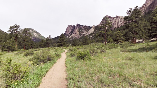
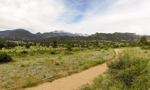
The run started easy enough with smooth wide trails, gently rolling terrain, and beautiful mountain views.

Black Canyon Trail
Longs Peak just left of center

Black Canyon Trail
The Needles

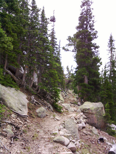
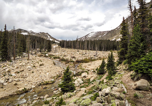
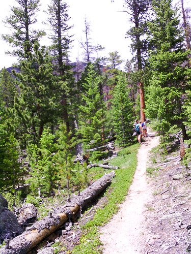
After climbing 500 feet or so the trail grew more narrow, rocky, and tree covered.

Black Canyon Trail

Black Canyon Trail

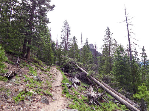
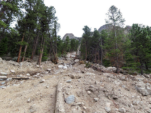
There was a short section that appears to have been taken out by an avalanche or rock slide.

Avalanche damage?

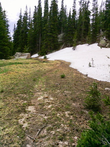
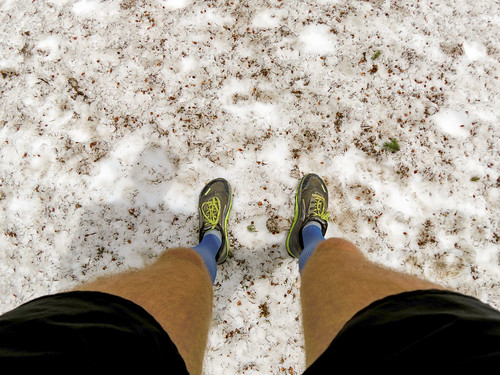
Above 10,000 feet I started to see snow, and the trail got a little wet in a few places from all the snow melt.

Black Canyon Trail

Black Canyon Trail

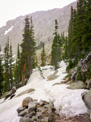
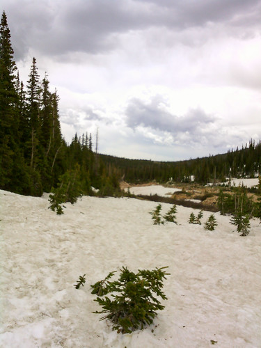
After a bit the snow was much more prevalent. It covered the trail in many places, making navigation a bit tricky. It was super slippery and often off-camber. With each step I didn’t know whether the snow would support me, or whether I’d sink up to my knee, or whether I’d slide off to the side. It made for slow going.

Sometimes the snow made navigation difficult

Black Canyon Trail

There was snow above 10,400 ft

Sometimes the snow made navigation difficult

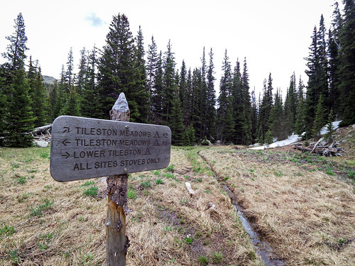
The Black Canyon trail I was on eventually (a mile farther than the map I used for planning indicated) met up with the Lawn Lake trail at the Roaring River.

Black Canyon Trail

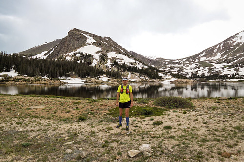
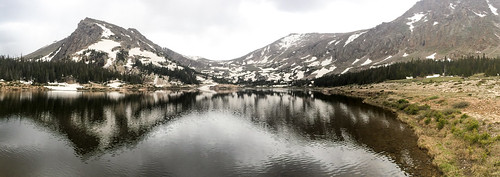
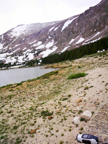
A bit farther, at 11,000 feet (just below tree line), was Lawn Lake in all its splendor.

Lawn Lake

Lawn Lake
Apparently the shore where I’m standing used to be under water before the dam collapsed in 1982.

Lawn Lake

The views were totally worth the hours of running and hiking it took to get there. Of course, shortly after I arrived the weather turned and it began to rain on me. It was already a bit chilly at that altitude. I put on my jacket and started to run back down. In what seemed like a matter of minutes I went from chilly, rainy, with numb hands to sweltering heat and baking in the bright sun.

Black Canyon Trail

The 19-20 mile round trip took a bit longer than I anticipated. This was partly due to incorrect (low) distance estimates, partly due to the heavy snow cover in places, and mostly due to my tired legs after last weekend’s marathon and two hard hill workouts this week (14,000 feet total ascent in the last 8 days, by far the most I’ve ever done). I ran out of water and the last couple miles were pretty rough, despite the relatively easy terrain. But Melissa and Will were waiting for me at the parking lot with a cooler full of cold water and I pepped back up pretty quickly.

The next time I’m up at Rocky with time for a long run I’d definitely consider doing this one again. With fresher legs, more drinking water, and less snow on the trail this would be much easier. I might even be able to continue on up to the surrounding mountain peaks. Though, I understand there’s many great places to run there, and it might be hard to justify doing the same route again when there’s so much else to explore.

This is just the beginning.

The Long Way Home

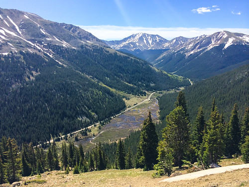
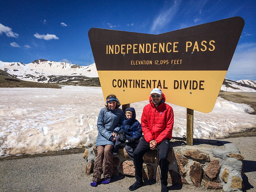
The day after the Leadville Trail Marathon we had to check out of our hotel room by 10 AM and we had no plans the rest of the day. So we decided to take a scenic drive to nearby Independence Pass (12,095 ft).

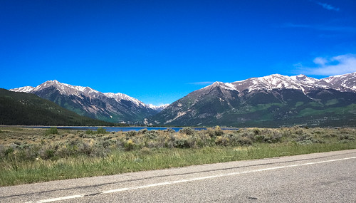
Twin Lakes

Midway up Independance Pass

Independance Pass

Independance Pass

Then we proceeded home on the usual route over the less interesting Fremont Pass (11,318 ft).

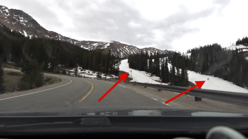
Then I figured while we were taking scenic drives we might as well skip the Eisenhower Tunnel and take Loveland Pass (11,990 ft) instead (where we saw people skiing in June at Arapaho Basin).

Skiing in June

Ah, screw it. Instead of taking the interstate back, let’s take US-40/34 over Berthoud Pass (11,307 ft)…

Milner Pass (10,759 ft), and on through Rocky Mountain National Park on Trail Ridge Road (12,183 ft).

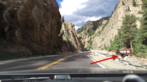
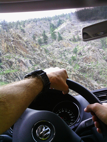
Finally, we passed through the beautiful Big Thompson Canyon, which was still being rebuilt from the massive floods last fall.

Big Thompson River Flood Damage

What should have been a simple 2h45m drive home turned into an all day affair. Melissa and Will were really struggling by the end, but they were good sports. After all it was Father’s Day and I appreciate them humoring me. I don’t think I will ever tire of driving through the mountains.

I love Colorado.

Leadville Trail Marathon

Last week I overhead a local runner mention that registration was still open for the Leadville Trail Marathon on Saturday. Perhaps a bit too embiggened by successfully doggy paddling through my first high altitude race at Pilot Hill, I thought I may as well jump into the deep end.

The marathon starts in Leadville at 10,200 feet above sea level (higher than I’ve ever run before) and goes up from there. The course consists of three big mountain climbs, the highest of which tops at at 13,185 feet. It was an excuse to race, an excuse to go back to Leadville (we briefly visited on our vacation last summer), an excuse for Melissa to get in a high altitude training run before she tackles the Estes Park Marathon next weekend, and an excuse to drive through some of the most beautiful scenery in the country.

We arrived for packet pickup on Friday. After a couple hours at that elevation I got a headache (just like last summer). This didn’t bode well. That night I was getting winded walking back and forth in our hotel room. I didn’t sleep well. But when I woke up I felt like a hundred dollars. Game on.

A late trip to the porta potty left me pretty far back at the start line of 1100 combined marathon and half marathon runners. No matter, I was fully intending to start slowly, as I had yet to run farther than across the street at that altitude. I honestly had no idea how my body would react.
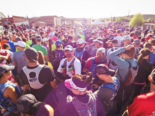
Leadville Trail Marathon start

Well, it was a bit ridiculous. People were running far slower than even my slowest estimate, so I worked my way up the outside. There were people who started near the front who stopped to walk after just a half mile. I spent the first 1.5 miles passing a couple hundred people. As the marathon runners split apart from the half marathon runners I counted the people ahead of me and I was 29th marathoner.
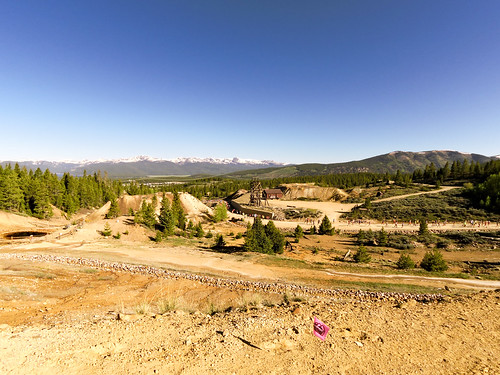
Early miles

I wasn’t running super fast, but my legs and breathing felt reasonably good at this point. My mouth and throat were super dry from the parched air. This made it difficult to drink my somewhat sugary sport drink. So I got behind on hydration early in the race. That was a bit unexpected.
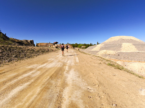
Early miles

I ran (slowly) the first climb while several people in front of me starting hiking. By the first downhill section I was up to 20th place or so. I picked up a few more on the downhill then a few more as we began the push toward the first mountain summit.
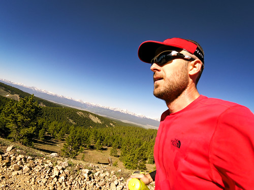
Tree line

During the early miles I was gradually catching up to one runner who looked fairly distinctive. He was wearing Hoka shoes and shirt, in his 40’s, clean cut. After chasing for a few miles I finally caught and passed him just before the summit. Of course, he blew past me on the descent, but I would catch back up later. I had made it as high as 11th place (I could see 5th-10th place within 100m of me) before dropping back a bit.
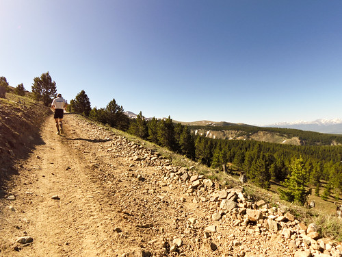
Ball Mountain climb

Melissa and Will were waiting for me at one of the aid stations just at the start of the climb up to Mosquito Pass, the high point on the course. I kept right on moving with a slow jog on the easier grades and as fast a hike as I could manage on the steeper grades. I came into the race fully expecting to hike (rather than run) most of this climb. It’s long, steep, and at very high altitude. My friend in the Hoka gear left me in the dust at this point. A few other marathon runners and I leapfrogged each other.
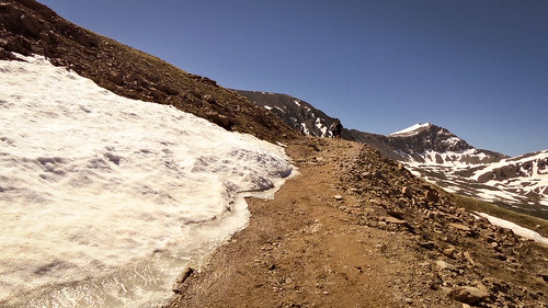
Mosquito Pass climb

The bigger ordeal was that the marathon and half marathon runners were now on the same course again, mixed together. But the marathon runners had covered about twice the distance by this point, so we were mixing it in with significantly slower runners. This wasn’t a problem early on in the climb where the trail was wide, but toward the top the trail became much more narrow and I was frequently held up trying to pass people with two-way traffic on the narrow trail.
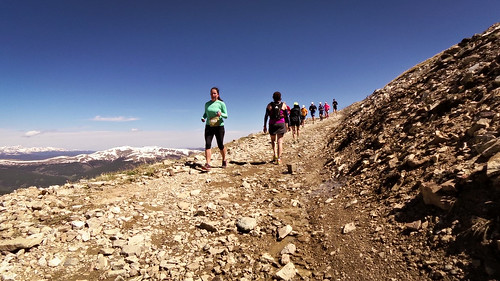
Mosquito Pass climb

After a long, arduous hike I reached Mosquito Pass (13,185 ft), took a selfie, and turned around and ran down. I was expecting the descent to be super fast and relatively easy. I was wrong on both accounts. The footing was terrible with lots of large loose rocks. There was two-way traffic on a relatively narrow trail. But my biggest problem was every time I tried to run fast (which should have been easy on a long downhill) I had fairly intense discomfort beneath my ribs. It wasn’t exactly my lungs, nor my stomach, but it was something, and it prevented me from getting up to any kind of speed.
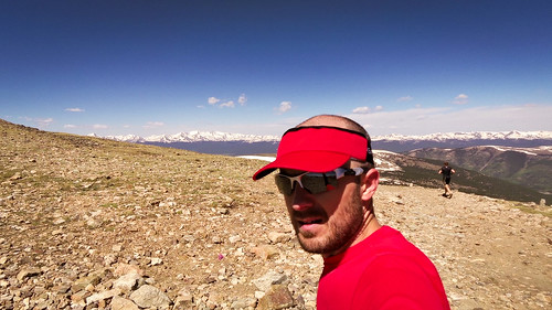
Mosquito Pass 13,185 ft

And that was just the beginning of my woes. After several miles of descending I had absolutely nothing left in my legs once I started back up the final mountain climb. I was expecting to run most (if not all) of it, just like I did on the way out, but I hiked every step. A couple times I tried to take a step forward and almost ended up going backward. It wasn’t pretty. This was the first section of the race where I couldn’t see anybody either in front of me or behind me. I was all alone for a solid mile up this interminable climb.
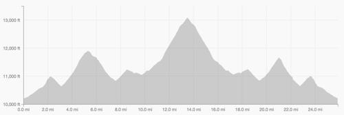
Screen Shot 2014 06 16 at 9 07 41 PM

Then as I neared the top, a pack of six guys passed me like I was standing still. Oh right, there’s a race going on. It was mostly downhill from there to the finish so I tried to get the wheels rolling again. I did okay until one last final uphill section where I struggled. Then it was all downhill to the finish. Except I couldn’t go because of the discomfort in my ribs/lungs/stomach area. I ran the last two miles at 6:40-6:50 pace and people were still passing me. There was a stiff headwind on the long final straightaway, prolonging my pain.

By the finish I had dropped to 28th place. I’m okay with that, even if it’s a far cry from where I was early in the race. I looked at the results and verified a few time checks before I came to the stunning realization that my friend in the Hoka gear was Dave Mackey (2011 Ultrarunner of the year). And then it hit me like a big fucking mountain (I may have literally slapped my own forehead), I screwed up. Big time. I had no business running with, much less passing, a runner of his caliber that early in the race. I didn’t feel like I was running too fast, but I was. It came back to bite me late in the race when I had trouble moving forward up the final mountain climb.

My time of 4:41:46 makes this my slowest marathon finish, though that was to be expected given that this was by far the most difficult course I’ve run. Surprisingly, I had less soreness in my legs after this race than just about any marathon I’ve ever run (I was prepared for the worst), though the soreness in my glutes (which I’ve never experienced before) may have made up for it.

Now that I’m a bit wiser and more experienced, I’d certainly be interested in coming back and racing in Leadville again. I think I could do things better the next time around.
Welcome to 7220

Pilot Hill 25K Classic

With all the training I’ve been doing it would be a shame not to throw a race in the mix. I’ve been a little apprehensive about doing so, though, due to, well, fear of sucking.

Vern's

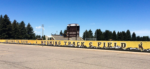
A bunch of people from Fort Collins were heading up to Laramie, WY for the Pilot Hill 25K (the oldest footrace in Wyoming) on Saturday, so I thought I might as well give it a go. On our way through Laramie we passed the University of Wyoming track, which sported the greeting “Welcome to 7220.” Feet. As in, “Welcome to high elevation. Good luck, buddy.”

Welcome

This race seemed simple enough: 2 miles flat, 6.5 miles uphill, 6.5 miles downhill. Wait, what? I’ve never raced that far uphill or that far downhill. I’ve never started a race more than 800 ft above sea level. What have I gotten myself into?

A high double digit number of participants toed the start line and we were off.

I started easy/cautious/scared shitless. My breathing was labored. Having just moved up into the top 10 I covered the first mile in just under 7 minutes. I was already struggling. I moved up a couple more places before we started the 6.5 mile long, 1600 ft climb to the top of Pilot Hill. As if the elevation and the ascent weren’t enough, we faced a stiff headwind the entire way up the hill. Welcome to Wyoming. I was moving in slow motion. It was demoralizing.

Around 8500 ft I started to get side stitches pretty bad. I struggled the rest of the way to the top, minutes behind the runners ahead of me, though not as far back as I was expecting. Maybe they’re half-human after all.

I took a quick drink of water at the aid station at the top before I turned around and bombed the downhill. I clicked off a bunch of 6:15 miles before the trail started to level out and I slowed a bit. I was starting to catch the runner in front of me, but at one point he simply vanished (I later found out he took a wrong turn). I maintained the status quo on the descent, not gaining any time on the 5 runners remaining ahead of me, while putting a few minutes into the next closest runners behind me.

I finished 6th place, 1st shirtless (it got hot by the end…). It was as good as I could have hoped to do. It was hard. Well, all races are hard, but this was hard in a slightly different way than most races I’ve done. Despite the big climb, this race was less hard on my legs and more hard on my lungs (if that makes any sense).

So now that my fears of racing at high elevation have been somewhat alleviated, I decided on a whim to jump into the deep end and run the Leadville Trail Marathon this coming weekend. It starts over 10,000 ft and climbs a couple of mountains up to 13,185 ft. The last time I decided to run a marathon a few days before the race it went pretty well. I don’t know what this weekend will have in store for me. But hey, what’s the worst that could happen?
May 2014

Blue Sky Trail

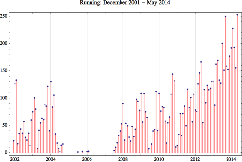
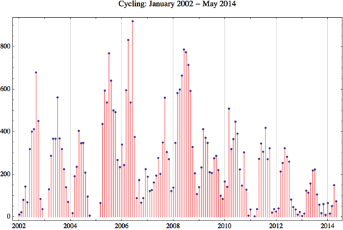
May has brought big changes. We moved across the country to Colorado. Since the terrain here is much different I’ve added ascent to my Running and Cycling charts below


Running

Horsetooth

The problem with racing is that it interferes with training. In May I took some time off from racing and as a result I put in a serious block of training. I took a few days off in the middle of the month for our move, then hit the ground running in Colorado. I ran more miles in May than any other month on record, while at the same time putting in more ascent. While my typical 9-10 mile training runs in Saint Louis contained about 400 ft of ascent, the corresponding training runs here contain about 1000-2000 ft (depending on whether I choose an easy route or a hard route). I typically run more hilly routes on the weekends as well, and that hasn’t changed.
As I prepare to start racing out here I face three big challenges.
  1. The elevation. I’ve lived my whole life basically at sea level, so running a mile above sea level now is quite a bit more difficult. Each day feels a little bit easier though.

  2. The uphills. Running uphill is not my strong suit. Now with more opportunities I’m working hard to improve.

  3. The competition. There’s a much higher concentration of great runners here than there is in Illinois or Missouri (and who can blame them?). I can’t really do much about that, so I’ll have to raise my game to stay competitive.

Month Workouts Total Dist Avg Dist Total Ascent Avg Ascent
January 19 192.03 miles 10.11 miles 9620. feet 506.32 feet
February 19 227.4 miles 11.97 miles 12301. feet 647.42 feet
March 17 192.96 miles 11.35 miles 10819. feet 636.41 feet
April 15 155.20 miles 10.35 miles 10947. feet 729.80 feet
May 24 252.5 miles 10.52 miles 20364. feet 848.5 feet
Total 95 1030.34 miles 10.85 miles 65253. feet 686.87 feet

Running 2014 5


Cycling

Race

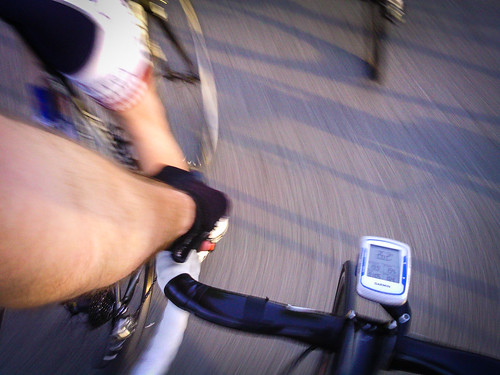
While the hills are much bigger here in Fort Collins, there is also much more flat ground as well. Nearly everything in Saint Louis is rolling hills, while here it’s at either end of the spectrum. I haven’t been out on my bike as much as I’d like, due to, um, scheduling conflicts with my running.

Month Workouts Total Dist Avg Dist Total Ascent Avg Ascent
January 4 64.74 miles 16.19 miles 1114. feet 278.5 feet
February 1 15.9 miles 15.9 miles 0. feet 0. feet
March 2 51.18 miles 25.59 miles 2115. feet 1057.5 feet
April 6 148.91 miles 24.82 miles 6250. feet 1041.67 feet
May 4 73.05 miles 18.26 miles 2810. feet 702.5 feet
Total 18 372.34 miles 20.69 miles 13444. feet 746.89 feet

Cycling 2014 5


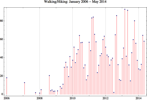
Walking/Hiking

Trash

Month Workouts Total Dist Avg Dist
January 11 27.72 miles 2.52 miles
February 11 26.8 miles 2.44 miles
March 11 32.72 miles 2.97 miles
April 23 64.33 miles 2.80 miles
May 20 57.9 miles 2.9 miles
Total 77 213.97 miles 2.78 miles

Walking 2014 5